Schermer (Alkmaar)
 flag |
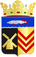
 coat of arms |
| province |
|
| local community |
|
|
Area - land - water |
64.39 km 2 61.27 km 2 3.12 km 2 |
| Residents | 5,452 (December 31, 2014) |
| Coordinates | 52 ° 36 ′ N , 4 ° 51 ′ E |
| Important traffic route |
|
| prefix | 0299, 072 |
| Postcodes | 1636, 1841-1847 |
Schermer ( West Frisian Skirmare ; in the dialect also Skirmer and Skermer ) was a municipality and at the same time a polder in the Dutch province of North Holland . The municipality not only included the polder of the same name, but also the Oterleek polder, the Mijzenpolder and the Eilandspolder. Only the localities of Stompetoren (with the seat of the municipal administration) and Zuidschermer are on the Schermer polder. Since January 1st, 2015 Schermer belongs to the municipality of Alkmaar .
Localities
The following villages and a peasantry belonged to Schermer.
Villages
- Driehuizen
- Grootschermer
- Oterleek
- Schermerhorn
- Stompetoren (Town Hall)
- Ursem (only the polder O, the village center of Ursem is in the municipality of Koggenland )
- Zuidschermer
Peasantry
- Huigendijk (partially)
history
Around 1200 years ago, the area in which the municipality of Schermer is located was a vein area through which the river Schermer flowed. In 1250 the river was turned into an inland lake by hand and connected to the IJsselmeer.
The name Schermer is derived from skir mere , which means "clear lake". The parish belonged to different areas: Rekere, Westflinge and Waterland.
Most of the lake was polded in the 17th century. The southern part, today's Alkmaarer See (Dutch Alkmaarder Meer ) remained untouched. In 1635 the 47.7 km² large polder fell dry.
On January 1, 2015 Schermer was incorporated into the municipality of Alkmaar.
politics
Distribution of seats in the municipal council
| Political party | Seats | |
|---|---|---|
| 2006 | 2010 | |
| Schermer concern | 3 | 4th |
| CDA | 3 | 3 |
| VVD | 2 | 2 |
| PvdA | 3 | 2 |
| total | 11 | 11 |
Attractions
Sons and daughters
- Steven Rooks (* 1960), former racing cyclist
- André Krul (* 1987), soccer goalkeeper
Web links
swell
Individual evidence
- ↑ Bevolkingsontwikkeling; regio per maand Centraal Bureau voor de Statistiek , accessed on April 17, 2018 (Dutch)
- ↑ Result of the local elections , accessed on April 17, 2018 (Dutch)
- ↑ Allocation of seats in the municipal council , accessed on April 17, 2018 (Dutch)
Other sources
- G. Van de Ven (Ed.): Leefbaar laagland. 4th, amended edition. Uitgeverij Matrijs, 1996, ISBN 90-5345-031-9 , pp. 33-35, 55-57, 104 and 131-136.
- T. Groenedijk: Nederlandse plaatsnames . Slingenberg Boekproducties, Hoogeveen 2000, ISBN 90-76113-81-5 .
