Shoddy
| Shoddy | ||
|---|---|---|
|
Summit ridge of the Schimbrig |
||
| height | 1815 m above sea level M. | |
| location | Entlebuch region , Hasle municipality (LU) | |
| Mountains | Emmental Alps | |
| Dominance | 3.5 km → Äbnistettenflue | |
| Notch height | 346 m ↓ Ober Loegg | |
| Coordinates | 651 419 / 198 949 | |
|
|
||
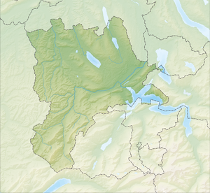
The Schimbrig is an 1815 m above sea level. M. high mountain in Entlebuch in the canton of Lucerne .
Location and surroundings
The Schimbrig has a long back, which is located in the southwest-northeast axis. The extension runs southwest over the Schafmatt towards Schrattenfluh . In the west, the Schimbrig falls into the Schimbrig Bad. In the south it falls into a valley in which the pass road to the Glaubberg is located.
Pastor Joseph Xaver Schnyder von Wartensee (1750–1784) first mentioned a sulfur fountain in 1782 on the Schimbrig. At the beginning of the 19th century, water began to be bottled and sold there. In 1854 Peter Thalmann from Schüpfheim bought the sulfur springs and built the Schimbrig Bad spa.
Map and literature
- National map of Switzerland , 1: 25,000, sheet 1169, Schüpfheim
Individual evidence
- ↑ The Schimbrigbad - as spa guests bathed in sulfur water on heiligkreuz-lu.org. Source: The Art Monuments of the Canton of Lucerne, The Entlebuch Office


