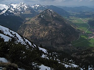
Seebergkopf
| Seebergkopf | ||
|---|---|---|
|
Seebergkopf from the east |
||
| height | 1538 m | |
| location | Bavaria , Germany | |
| Mountains | Mangfall Mountains | |
| Dominance | 2.55 km → Kleiner Traithen | |
| Notch height | 484 m ↓ at the Niederhoferalm | |
| Coordinates | 47 ° 39 ′ 51 ″ N , 11 ° 59 ′ 52 ″ E | |
|
|
||
At 1538 meters, the Seebergkopf is the highest point on the Seeberg near Bayrischzell in the Mangfall Mountains . It can be reached in an easy hike over mountain paths and climbs from the valley town of Bayrischzell (800 m) via the Neuhüttenalm at 1232 m - the oldest still existing Leitzachtaler Alm, a log building from 1678 - and the Seebergalm (1360 m) . A major landslide on its north side is striking. The name Seebergkopf comes from a lake that used to exist near the summit (in the direction of Seebergschneid), the outline of which can still be seen today.
gallery
Web links
Commons : Seeberg (Mangfall Mountains) - Collection of images
- Website with tour description
- Tour info with map, altitude profile and various GPS tracks
- Website with tour profile
Individual evidence
- ↑ See Heinrich Brauregger: Tegernseer and Schlierseer Berge. Bergverlag Rother , 5th edition Munich 2007, pp. 70/71


