Seljalandsfoss
| Seljalandsfoss | ||
|---|---|---|
|
The Seljalandsfoss |
||
| Coordinates | 63 ° 36 '56.2 " N , 19 ° 59' 16.4" W | |
|
|
||
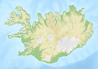
| place | Hvolsvöllur , Skógar , Iceland | |
| height | 66 m | |
| flow | Seljalandsá → Markarfljót | |
The Seljalandsfoss [ sɛljalantsˌfɔsː ] is a waterfall in southern Iceland .
It is located in the municipality of Rangárþing eystra on the ring road between Hvolsvöllur and Skógar right at the junction of the slope towards Þórsmörk . The Seljalandsá river plunges 66 m deep over the former coastline into the flood plain of the Markarfljót , into which it flows shortly afterwards. Like many of its kind, including the famous Skógafoss , the waterfall is located below the large glacier shield Eyjafjallajökull .
You can walk behind the waterfall and look out over the land through the water veils. A visit in the late evening hours, when the colors are most intense, is particularly recommended.
There is a small campsite right next to the waterfall.
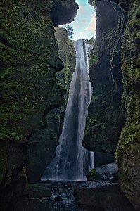
If you walk along the rock face to the west towards Þórsmörk, you will pass numerous smaller falls, the most beautiful of which is Gljúfrabúi or Gljúfurárfoss . The first name means gorge dweller , because the waterfall is partially hidden in a half-open cave.


