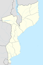
Sena (Mozambique)
| Sena | ||
|---|---|---|
|
|
||
| Coordinates | 17 ° 28 ′ S , 35 ° 3 ′ E | |
| Basic data | ||
| Country | Mozambique | |
| Sofala | ||
| District | Chinde | |
| ISO 3166-2 | MZ-S | |
| height | 69 m | |
| Residents | 4000 | |
Sena (also Vila de Sena ) is a town in the province of Sofala in Mozambique .
geography
Sena is located on the southern bank of the Zambezi at an altitude of 69 m .
population
The city has 4,000 inhabitants.
history
Sena has been an Arab trading post since the 11th century . The area belonged to the Munhumutapa empire . The Portuguese took over Sena, as well as Tete to the north-west , in the 16th century, expanded it into a town and built a fortress here in the 18th century.
Economy and Infrastructure
Sena is the central market town for local products in the region and a center of sugar cane cultivation ( Sena Sugar Estates Ltd. ).
The city lies on the railway line from Beira to Moatize and Malawi of the Caminhos de Ferro de Moçambique - Central.
The railway crosses the Zambezi on the Dona Ana Bridge . This bridge, built in 1935, is 3.7 kilometers long, making it the longest in Africa. It was built with several iron arches and supporting pillars and was expanded for road traffic in 2006/07. On the other bank is Nhamayabue , the former Dona Ana . There is a 1000 meter long airfield and a river port.
During the rainy season, especially in January, the roads in this area are often impassable because the Zambezi then overflows its banks.
