Tete (city)
| Tete | ||
|---|---|---|
|
|
||
| Coordinates | 16 ° 9 ′ 31 ″ S , 33 ° 34 ′ 59 ″ E | |
| Basic data | ||
| Country | Mozambique | |
| Tete | ||
| ISO 3166-2 | MZ-T | |
| height | 140 m | |
| surface | 49.3 km² | |
| Residents | 305,722 (2017) | |
| density | 6,198.7 Ew. / km² | |
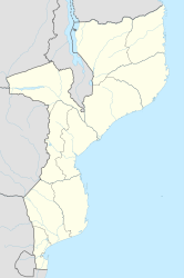
Tete is a town on the Lower Zambezi in the Mozambique province of the same name .
geography
Tete is around 140 m above sea level on a plateau that rises up to 30 meters above the river on the western bank, opposite the mouth of the Revuboe River . The districts on the east bank of the river belong to the city of Moatize .
Tete is one of the hottest places in Mozambique and has high humidity.
| Tete | ||||||||||||||||||||||||||||||||||||||||||||||||
|---|---|---|---|---|---|---|---|---|---|---|---|---|---|---|---|---|---|---|---|---|---|---|---|---|---|---|---|---|---|---|---|---|---|---|---|---|---|---|---|---|---|---|---|---|---|---|---|---|
| Climate diagram | ||||||||||||||||||||||||||||||||||||||||||||||||
| ||||||||||||||||||||||||||||||||||||||||||||||||
|
Average monthly temperatures and precipitation for Tete
Source: wetterkontor.de
|
|||||||||||||||||||||||||||||||||||||||||||||||||||||||||||||||||||||||||||||||||||||||||||||||||||||||||||||||||||||||||||||||||||||||||||||||||||||||||||||||||||||
population
The city has 305,722 inhabitants (2017 census).
history
Tete was once an outpost of Arab trade on the territory of the Munhumutapa Empire and was taken over by the Portuguese in 1531 . It is an old garrison town and, together with Sena, dominates the Zambezi Valley from the mouth of the Luenha to the Indian Ocean, 420 kilometers (630 river kilometers) away . From the 18th century onwards, 100 soldiers were permanently stationed here, which made the city the regional center of colonial administration. 30 stone buildings date from this period, including a cathedral, a hospital and the governor's palace, which is enclosed by a three-meter-high stone wall. Another historic building, the Jesuit Boroma Mission , is 32 kilometers away from Tete. For a long time the city was the center of gold prospectors, who could easily penetrate from here to Zimbabwe as well as to Manica and Massi Kessi . The ivory trade and, after 1650, slave hunting also had a center here.
The large buildings and hotels of the colonial era have been neglected since the beginning of the civil war in 1975.
Economy and Infrastructure
About ten kilometers northeast of Tete, across the Zambezi, are the most important coal mines in the Moatize district , in which massive investments have been made since 2006. The start of open pit mining in 2011 led to massive environmental pollution. At the same time, there was an explosion in rental costs due to the housing needs of thousands of workers who had moved there.
The EN7 national road , which is well-frequented and is now paved throughout , runs through Tete and leads from Blantyre and Mwanza in Malawi via Tete to Nyamapanda and to Harare in Zimbabwe . The route is also called the Tete Corridor .
In Tete, two bridges span the Zambezi River: the two-lane Ponte Samora Machel, opened in 1973, and the larger Ponte de Kassuende, opened in 2014 . Both are of strategic importance to Tete, as they are the only two possible crossings of the river in a wide area. The Dona Ana Bridge , a railway bridge and a ferry are only 200 km to the southeast . To the north, 120 km upriver, is the Cabora Bassa dam , which only pedestrians can cross.
In the north of Tete, on the river side of Moatize, there is a 2,800 meter long, asphalt runway with an air terminal.
sons and daughters of the town
- Sérgio Vieira (* 1941), lawyer and Mozambican politician (FRELIMO) of Portuguese descent, former minister
- José Castelo Branco (* 1962), Portuguese art dealer and figure of the jet set
- Liloca (* 1985), Mozambican singer and dancer
