
Transmitter Tuttlingen (Witthohsteige)
|
Transmitter Tuttlingen (Witthohsteige)
Radio transmission point Tuttlingen 2
|
||||
|---|---|---|---|---|
 |
||||
| Basic data | ||||
| Place: | Tuttlingen | |||
| Country: | Baden-Württemberg | |||
| Country: | Germany | |||
| Altitude : | 801 m above sea level NHN | |||
| Coordinates: 47 ° 57 '55.8 " N , 8 ° 49' 16.8" E | ||||
| Use: | Telecommunication system , radio transmitter | |||
| Owner : | German radio tower | |||
| Mast data | ||||
| Building material : | steel | |||
| Total height : | 58.5 m | |||
| Data on the transmission system | ||||
| Waveband : | FM transmitter | |||
| Radio : | VHF broadcasting | |||
| Send type: | Cellular | |||
| Position map | ||||
|
||||


The Tuttlingen transmitter (Witthohsteige) is a transmitter system on the Witthoh in Tuttlingen . It is located on the Witthoh, about two kilometers south of Tuttlingen city center.
From here, the city of Tuttlingen is supplied with the antenna 1 Neckarburg Rock & Pop program on the 107.6 MHz FM frequency and a transmission power of 0.1 kW.
Frequencies and Programs
Analog radio ( FM )
In the case of directed radiation, the main radiation directions are given in degrees in the antenna diagram.
|
Frequency (MHz) |
program | RDS PS | RDS PI | Regionalization |
ERP (kW) |
Antenna diagram round (ND) / directional (D) |
Polarization horizontal (H) / vertical (V) |
|---|---|---|---|---|---|---|---|
| 107.6 | antenne 1 Neckarburg Rock & Pop | - | - | - | 0.1 | D (230 ° -90 °) | H |

Lower part of the transmitter mast at the Tuttlingen transmitter (Witthohsteige)

Kind regards from the station Tuttlingen (Witthohsteige)

Wooden transmitter house at the Tuttlingen transmitter (Witthohsteige)
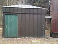
Transmitter house at the transmitter Tuttlingen (Witthohsteige)


