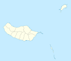
Serra de Água
| Serra de Água | ||||||
|---|---|---|---|---|---|---|
|
||||||
| Basic data | ||||||
| Autonomous Region : | Madeira | |||||
| Concelho : | Ribeira Brava | |||||
| Coordinates : | 32 ° 44 ′ N , 17 ° 2 ′ W | |||||
| Residents: | 1049 (as of June 30, 2011) | |||||
| Surface: | 24.16 km² (as of January 1, 2010) | |||||
| Population density : | 43 inhabitants per km² | |||||
| Postal code : | 9350-323 | |||||
| politics | ||||||
| Mayor : | Carlos dos Ramos Andrade ( PSD ) | |||||
| Address of the municipal administration: | Junta de Freguesia de Serra de Água Rua Dr. Jordão Faria Paulino, 12 9350-323 Serra de Água |
|||||
Serra de Água is a Portuguese municipality ( freguesia ) in the district ( concelho ) of Ribeira Brava , on the island of Madeira . 1049 inhabitants live in it (as of June 30, 2011).
history
During the settlement of the island from the early 15th century, Serra de Água also emerged. In 1676 the independent municipality of Serra de Água was created. It was part of the Ponta do Sol district , and since 1914 it has been part of the newly created Ribeira Brava district.
In 1953, the island's first hydropower plant was built in the municipality.
Web links
Commons : Serra de Água - Collection of images, videos and audio files
Individual evidence
- ↑ a b www.ine.pt - indicator resident population by place of residence and sex; Decennial in the database of the Instituto Nacional de Estatística
- ↑ Overview of code assignments from Freguesias on epp.eurostat.ec.europa.eu
- ↑ Community portrait on the district website ( memento of the original from July 23, 2013 in the Internet Archive ) Info: The archive link was inserted automatically and has not yet been checked. Please check the original and archive link according to the instructions and then remove this notice. , accessed on August 31, 2013


