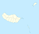
Ribeira Brava (Madeira)
| Ribeira Brava | ||||||
|---|---|---|---|---|---|---|
|
||||||
| Basic data | ||||||
| Autonomous Region : | Madeira | |||||
| Concelho : | Ribeira Brava | |||||
| Coordinates : | 32 ° 40 ′ N , 17 ° 4 ′ W | |||||
| Residents: | 6588 (as of June 30, 2011) | |||||
| Surface: | 18.48 km² (as of January 1, 2010) | |||||
| Population density : | 356 inhabitants per km² | |||||
| Postal code : | 9350 | |||||
| Ribeira Brava district | ||||||
|
||||||
| Residents: | 13,375 (as of June 30, 2011) | |||||
| Surface: | 65.41 km² (as of January 1, 2010) | |||||
| Population density : | 204 inhabitants per km² | |||||
| Number of municipalities : | 4th | |||||
| administration | ||||||
| Administration address: | Câmara Municipal de Ribeira Brava Rua do Visconde, N.º 56 9350-213 Ribeira Brava |
|||||
| President of the Câmara Municipal: | José Ismael Fernandes ( PSD ) | |||||
| Website: | www.cm-ribeirabrava.pt | |||||
Ribeira Brava is a Portuguese small town ( vila ) and a district ( concelho ) on the island of Madeira , which is about 15 km west of Funchal in the south of the island. In the community 6588 people (as of June 30, 2011) live on 18.5 km². The population density is 357 inhabitants per km².
history
The place was settled at the beginning of the 15th century, shortly after Funchal and Machico . In 1676 Ribeira Brava became an independent municipality. Ribeira Brava has been a separate district since 1914, making it the youngest district on the island. In 1928 the place was raised to a Vila (small town).
coat of arms
In a green shield, four silver five-pointed stars next to each other above a silver five-pointed tower with a closed gate and two black windows, which stands over a silver river . A four-tower wall crown rests on the shield . In the white band at the base of the shield, the place name in green letters “RIBEIRA BRAVA”.
Public facilities and transport
In Ribeira Brava there is a primary school, a secondary school, a grammar school, a church and a public central square (Praça).
The village is on road no. 104, which connects to the VR1 expressway in the direction of Funchal.
Local public transport is ensured by various bus routes operated by the Rodoeste bus company.

Green area at the town hall ( Câmara Municipal ) of Ribeira Brava
|
administration
Ribeira Brava district
Ribeira Brava is the seat of a district of the same name ( concelho ). The district of Ribeira Brava is divided into 4 parishes ( Freguesias ).
Communities
| local community | Population (2011) |
Area km² |
Density of population / km² |
LAU code |
|---|---|---|---|---|
| Campanário | 4,582 | 11.74 | 390 | 310701 |
| Ribeira Brava | 6,588 | 18.48 | 357 | 310702 |
| Serra de Água | 1,049 | 24.16 | 43 | 310703 |
| Taboo | 1,156 | 11.03 | 105 | 310704 |
| Ribeira Brava district | 13,375 | 65.41 | 204 | 3107 |
Neighboring areas
| Sao Vicente | ||
| Ponta do Sol |

|
Câmara de Lobos |
| Atlantic Ocean |
Population development
| 1920 | 1930 | 1960 | 1981 | 1991 | 2001 | 2004 | 2011 |
|---|---|---|---|---|---|---|---|
| 14,132 | 16,394 | 19,793 | 13,480 | 13,170 | 12,494 | 12,523 | 13,362 |
Municipal holiday
- June 29th
Web links
Individual evidence
- ↑ www.ine.pt - indicator resident population by place of residence and sex; Decennial in the database of the Instituto Nacional de Estatística
- ↑ a b Overview of code assignments from Freguesias on epp.eurostat.ec.europa.eu
- ↑ www.ine.pt - indicator resident population by place of residence and sex; Decennial in the database of the Instituto Nacional de Estatística
- ↑ www.monumentos.pt (under Cronologia ), accessed on August 31, 2013
- ↑ Local traffic page of the district website ( memento of the original from September 11, 2014 in the Internet Archive ) Info: The archive link was inserted automatically and has not yet been checked. Please check the original and archive link according to the instructions and then remove this notice. , accessed on August 31, 2013


