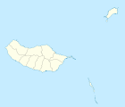
Santana (Madeira)
| Santana | ||||||
|---|---|---|---|---|---|---|
|
||||||
| Basic data | ||||||
| Autonomous Region : | Madeira | |||||
| Concelho : | Santana | |||||
| Coordinates : | 32 ° 48 ′ N , 16 ° 52 ′ W | |||||
| Residents: | 3275 (as of June 30, 2011) | |||||
| Surface: | 19.01 km² (as of January 1, 2010) | |||||
| Population density : | 172 inhabitants per km² | |||||
| Height: | 575 m | |||||
| Santana County | ||||||
|
||||||
| Residents: | 7719 (as of June 30, 2011) | |||||
| Surface: | 95.56 km² (as of January 1, 2010) | |||||
| Population density : | 81 inhabitants per km² | |||||
| Number of municipalities : | 6th | |||||
| administration | ||||||
| Administration address: | Câmara Municipal de Santana Sítio do Serrado 9230-116 SANTANA |
|||||
| President of the Câmara Municipal: | Rui Moisés Fernandes de Ascensão ( PSD ) | |||||
| Website: | www.cm-santana.com | |||||
Santana (historically developed abbreviation for Santa Anna ) is a city ( cidade ) and a district ( concelho ) on the north coast of the Portuguese island of Madeira . 3275 inhabitants live on an area of 19 km² (as of June 30, 2011), which corresponds to a population density of 172.2 inhabitants / km².
Santana is famous for its traditional thatched farmhouses, the landmarks of Madeira Island. The farmers used to live in these simply furnished, often red-painted houses. Today most of them are empty and are only maintained as tourist attractions . The thatched roofs have to be replaced every four to five years.
Since 2011, the Santana district has been listed as a biosphere reserve by UNESCO .
history
The rediscoverer of Madeira, João Gonçalves Zarco , had the island settled for the first time in 1419 . Santana was also settled towards the end of the 15th century. In 1552 it became an independent municipality. In 1835 the independent district of Santana was established and the place received the status of a small town ( Vila ).
In 2000 Santana was elevated to a city ( Cidade ).
administration
Santana County
Santana is the seat of the district of the same name ( concelho ). The neighboring areas are Machico , Santa Cruz , Funchal , Câmara de Lobos and São Vicente .
The district is divided into six parishes ( Freguesias ):
| local community | Population (2011) |
Area km² |
Density of population / km² |
LAU code |
|---|---|---|---|---|
| Arco de Sao Jorge | 413 | 3.38 | 122 | 310901 |
| Faial | 1,567 | 24.03 | 65 | 310902 |
| Ilha | 255 | 14.19 | 18th | 310906 |
| Santana | 3,275 | 19.01 | 172 | 310903 |
| São Jorge | 1,473 | 19.34 | 76 | 310904 |
| Sao Roque do Faial | 736 | 15.61 | 47 | 310905 |
| Santana County | 7,719 | 95.56 | 81 | 3109 |
Population development
| Population in Santana County (1849–2011) | ||||||||
|---|---|---|---|---|---|---|---|---|
| 1849 | 1900 | 1930 | 1960 | 1981 | 1991 | 2001 | 2011 | |
| 11,641 | 9,337 | 10,908 | 13,971 | 11,253 | 10.302 | 8,804 | 7,719 | |
Municipal holiday
- 25. May
sons and daughters of the town
- Teodósio Clemente de Gouveia (1889–1962), Archbishop of Maputo , Mozambique
Web links
Individual evidence
- ↑ www.ine.pt - indicator resident population by place of residence and sex; Decennial in the database of the Instituto Nacional de Estatística
- ↑ a b Overview of code assignments from Freguesias on epp.eurostat.ec.europa.eu
- ↑ www.ine.pt - indicator resident population by place of residence and sex; Decennial in the database of the Instituto Nacional de Estatística
- ↑ History page on the district website ( memento of the original from April 7, 2014 in the Internet Archive ) Info: The archive link was inserted automatically and has not yet been checked. Please check the original and archive link according to the instructions and then remove this notice. , accessed on August 31, 2013
- ↑ www.monumentos.pt , accessed on August 31, 2013
- ↑ Information from the district website ( Memento of the original from November 5, 2013 in the Internet Archive ) Info: The archive link was automatically inserted and not yet checked. Please check the original and archive link according to the instructions and then remove this notice. , accessed on August 31, 2013


