Sierning (Schwarza)
|
Sierning Sierningbach |
||
|
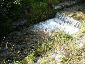
Sierningbach in Puchberg am Schneeberg |
||
| Data | ||
| location | Lower Austria | |
| River system | Danube | |
| Drain over | Schwarza → Leitha → Danube → Black Sea | |
| muzzle |
Wimpassing in the Schwarza coordinates: 47 ° 42 ′ 45 ″ N , 16 ° 2 ′ 21 ″ E 47 ° 42 ′ 45 ″ N , 16 ° 2 ′ 21 ″ E |
|
| Mouth height |
380 m above sea level A.
|
|
| Catchment area | 113.6 km² | |
| Right tributaries | Sebastianbach , Rohrbach | |
| Communities | Puchberg am Schneeberg , Ternitz | |
The Sierningbach is a river in southern Lower Austria , in the market town of Puchberg am Schneeberg . It rises in the area of the Dürren Wand and flows approximately southeast through Puchberg and the Sierningtal to Ternitz , where it flows into the Schwarza from the left .
Previous use
Water from the Schneeberg area is primarily known as the highest quality drinking water for the city of Vienna . That is why the 1st Vienna Spring Water Pipeline has been leading to Vienna since 1873 . The power of water was used in almost every stream in the region . There were a total of 38 sawmills in 1900 , but due to advancing electrification in the 20th century, they were left to decay. Some sawmills were also operated by the water power of the Sierningbach. Today only three gang saws are in operation.
Web links
Individual evidence
- ↑ BMLFUW (ed.) : List of areas of the river areas: Leitha, Rabnitz and Raab areas. In: Contributions to Austria's hydrography, issue No. 63, Vienna 2014, pp. 11/29. PDF download , accessed July 7, 2018.
