Smithtown Bay
| Smithtown Bay | ||
|---|---|---|
|
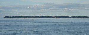
View from Nissequogue to Crane Neck |
||
| Waters | Long Island Sound | |
| Land mass | long Island | |
| Geographical location | 40 ° 56 ′ N , 73 ° 13 ′ W | |
|
|
||
| width | approx. 20 km | |
| Tributaries | Nissequogue River | |
As Smithtown Bay , part of the Long Iceland sound on the central north coast of Long Iceland , on the banks of the cities Smithtown and Brookhaven , respectively. It extends between the Duck Island peninsula in the west and Cape Crane Neck in the east, which corresponds to a diameter of around 20 kilometers. From the line connecting these two points, the main bay extends a maximum of six kilometers inland, with smaller, heavily separated secondary bays such as the Stony Brook Harbor and the mouth of the Nissequogue River penetrating further.
The towns of Asharoken , Fort Salonga , Kings Park , Nissequogue , Stony Brook and Old Field lie along the bay from east to west. Head of the Harbor and the main town of Smithtown also have a share in the minor bays . The next, smaller bays are Northport Bay and Huntington Bay to the west, and Port Jefferson Harbor to the east .

