Śniardwy
| Śniardwy | ||
|---|---|---|

|
||
| Geographical location | Masurian Lake District | |
| Islands | 8th | |
| Location close to the shore | Ruciane-Nida , Mikołajki and Pisz | |
| Data | ||
| Coordinates | 53 ° 46 ′ N , 21 ° 45 ′ E | |
|
|
||
| Altitude above sea level | 117 m npm | |
| surface | 113.8 km² | |
| Maximum depth | 23.4 m | |
| Middle deep | 6.5 m | |
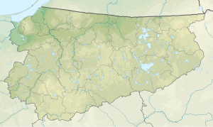
The Śniardwy ( [ˈɕɲardvɨ] , German Spirdingsee ) is a 114 km² large lake in the Polish Warmian-Masurian Voivodeship . The lake in historic East Prussia is the largest lake in Poland and until 1945 was the largest inland lake located entirely in Germany (the largest inland lake, the Müritz , is 112.6 km² in size today ). The Spirdingsee belongs to the Masurian Lake District and is 22.1 km long and 13.4 km wide. The next largest Masurian lake, the Mauersee , is 104 km² in size.
The lake is relatively shallow with a maximum depth of 23.4 m.
location
The Spirdingsee is connected to the Nikolaiker See , the Beldahnsee and the Lucknainer See by a narrow canal . The southern part of the Spirdingsee is called Sexter See . There is a connection to the Roschsee via the Jeglinner / Wagenauer Canal, which branches off from Lake Sexter and was built from 1845 to 1849 .
The lake includes eight islands. In the southern part of the lake there are the two islands Langenwerder and Teufelswerder (in Polish: Czarci Ostrów ), as well as the ( pen ) islands of Spirdingswerder ( Szeroki Ostrów ) and Friedrichswerder, which are connected to the mainland by dams. Fort Lyck stood on Teufelswerder from 1784 and was soon demolished. The stones were used to build the Boyen Fortress . The island was settled early, many urns from prehistoric times were found there. On Teufelswerder there is an elevation that is clearly visible from the opposite village of Eckersberg (in Polish: Okartowo ), the distance of which appears larger or smaller to the observer depending on the weather, a phenomenon that previously indicated the imminent change in the weather to the villagers.
Nearby cities are Ruciane-Nida (Rudczanny-Nieden) , Mikołajki (Nikolaiken) and Pisz (Johannisburg) .
There are plans to connect the Spirdingsee with the Löwentinsee via the Türkle-See, the Martinshagener See and the Hessen-See over a new canal . A connection is also planned with the eastern Augustow Canal.
To the east of Spirdingwerder, paddle boats can be used to enter the Spirding-Roschsee Canal. Right at the start there is a weir to overcome at Wyszka. In contrast to Krutynia, this waterway is still unknown to canoeists.
literature
- August Eduard Preuss : Prussian country and folklore or description of Prussia. A manual for primary school teachers in the province of Prussia, as well as for all friends of the fatherland . Bornträger Brothers, Königsberg 1835, pp. 55–56, no. 16.
- Maria Biolik: Hydronymia Europaea, the names of the standing waters in the Pregel tributary area and in the catchment area of the tributaries to the Baltic Sea between Pregel and Memel. Stuttgart 1993.
- Georg Gerullis: The old Prussian place names. Berlin / Leipzig 1922.
- Rozalia Przybytek: Hydronymia Europaea, place names of Baltic origin in the southern part of East Prussia. Stuttgart 1993.
Web links
Footnotes
- ^ Wilhelm Johann Albert von Tettau and JDH Temme: The folk tales of East Prussia, Litthausen and West Prussia . New edition, Berlin 1865, pp. 172–173.
- ^ Wasserweg , Preußische Allgemeine Zeitung 201/13, April 3, 2010
