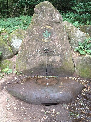
Spitzrain fountain
| Spitzrain fountain | |||
|---|---|---|---|
 Spitzrain Fountain (2017) |
|||
| location | |||
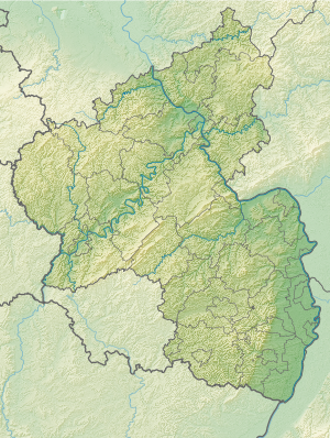
| Country or region | Kaiserslautern ( Rhineland-Palatinate ) | ||
| Coordinates | 49 ° 26 ′ 9 " N , 7 ° 48 ′ 25" E | ||
| height | 248 m above sea level NHN | ||
|
|||
| geology | |||
| Mountains | middle Palatinate Forest | ||
| Source type | Layer source | ||
| Exit type | collected source | ||
| Hydrology | |||
| River system | Rhine | ||
| Receiving waters | Lauter → Glan → Nahe → Rhine → North Sea | ||
Coordinates: 49 ° 26 ′ 9 ″ N , 7 ° 48 ′ 25 ″ E
The Spitzrainbrunnen is a spring in the city of Kaiserslautern in Rhineland-Palatinate .
geography
location
The source is located three kilometers southeast of Kaiserslautern at the end of the Saupferchtal at an altitude of 248 m above sea level. NHN . in the district of Spitzrain, northeast of the Betzenberg wildlife park . The spring is placed in a well.
Natural allocation
The Spitzrainbrunnen belongs to the Palatinate Forest natural area , which is classified as a 3rd order Greater Region in the systematics of the handbook of the natural spatial structure of Germany published by Emil Meynen and Josef Schmithüsen and its subsequent publications . If you look at the internal structure of the natural area , the Spitzrainbrunnen belongs to the Kaiserslauterer Senke , which delimits the Palatinate Forest in the south and east, the Zweibrücker Westrich in the southwest and the North Palatinate Uplands in the north.
In summary, the natural spatial allocation of the Roßberg follows the following system:
- Greater region 1st order: Layer level land on both sides of the Upper Rhine Rift
- Greater region 2nd order: Palatinate-Saarland layer level land
- Greater region 3rd order: Saar-Nahe-Bergland
- 4th order region (main unit): St. Ingbert-Kaiserslauterer Senke
- 5th order region: Kaiserslauter valley
Traffic and walking
From west to east, Landesstraße 504 and the Kaiserslautern - Neustadt railway line pass the Weinstraße . There is a parking lot for hikers right on the street. The shortest route leads south about 100 m from this through an underpass of the railway line to the source.
Others
The spring has water all year round. It can be removed without any problems, it does not contain any suspended matter.
Individual evidence
- ↑ LANIS: Spitz Rain fountain on topographical card from the service of the Landscape Information System of Nature Protection Administration Rhineland-Palatinate. Retrieved July 8, 2017 .
- ↑ Adalbert Pemöller: Geographical land survey: The natural spatial units on sheet 160 Landau i. d. Palatinate. Federal Institute for Regional Studies, Bad Godesberg 1969. → Online map (PDF; 4.2 MB)
- ↑ Helmut Beeger u. a .: The landscapes of Rheinhessen-Pfalz - naming and spatial delimitation. In: Reports on German regional studies , Volume 63, Issue 2, Trier, 1989, pp. 327–359
