
St. Maria in Lichtenklingen

St. Maria in Lichtenklingen in the Hessian Odenwald is around three kilometers south of Siedelsbrunn and almost two kilometers east of Unter-Abtsteinach in a valley head between Hardberg (593.1 m above sea level) and Stiefelhöhe (584 m above sea level) on the edge of the forest the ruins of a place of worship for Mary. The allegedly preceding Germanic or Celtic source sanctuary goes back to romantically or politically motivated ideas of the 19th and early 20th centuries.
Building structure
The single-nave, rectangular sacred building is approx. 15 m long and approx. 8 m wide and has a square choir with a side length of approx. 7.5 m and a sacristy with a side length of approx. 5 m, which was probably added in the 14th century . The rising masonry is still very well preserved or restored and gives a good impression of the original appearance of the building. The suspected older traces of settlement have not yet been proven archaeologically. Below the chapel there is a contained spring with a trough.
History and pilgrimage
It was probably built after 1200, but according to other views it may have been in the 11th or 13th century. The chapel was first mentioned in a document around 1387. In the 16th century, after the Reformation, it began to decline and in the late 16th century it was used as a quarry by the people of Lindenfels .
Pilgrimages to the Lichtenklinger chapel are mentioned for the first time in 1786. Excavations were carried out in 1910 and the first conservation work in 1911. In 1953 further conservation work was carried out. In 1980 the annual pilgrimages to Our Lady were resumed by the then Abtsteinach pastor Jakob Stumpf and the parish council chairman Herbert Oberle. Every year, the day of pilgrimage is the Sunday closest to the Feast of the Assumption (August 15th). Once a year there is a guided hike by the park rangers of the Bergstrasse-Odenwald Geo-Nature Park .
The closest car park is at the northern exit of Eiterbach .
Legend
When giving up “St. Maria in Lichtenklingen ”the statue of Mary was brought to the chapel in Unter-Abtsteinach. According to legend, the figure returned to Lichtenklingen three times in an unexplained manner before it stayed in the chapel, where it still stands today.

Light blades from the outside

Light blades interior with a view of the altar
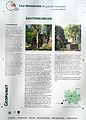
Sign board

View of the nature reserve


Literature and maps
- Norbert Wand: St. Maria in Lichtenklingen near Siedelsbrunn. In: Medieval hermitages, spring shrines and pilgrimage sites in the Odenwald, pp. 57–60. Lorsch: Laurissa, 1995. ISBN 3-922781-51-9 .
- Hessian Land Surveying Office: TF 20-9, Der Überwald. Topographic leisure map 1: 20,000. Wiesbaden: Hessisches Landesvermessungsamt, 2000. ISBN 3-89446-293-0 .
Web links
- On the mythology of the place on the website of the online magazine Odenwälder Echo
- On the etymology of the place name "Lichtenklingen"
- Pilgrimage Lichtenklingen Site of the parish of St. Bonifatius Ober-Abtsteinach
Coordinates: 49 ° 31 ′ 45.2 " N , 8 ° 48 ′ 29.5" E