Peñol-Guatapé reservoir
| Peñol-Guatapé reservoir - Guatapé hydropower plant |
|||||||||||
|---|---|---|---|---|---|---|---|---|---|---|---|
| Peñol-Guatapé reservoir | |||||||||||
|
|||||||||||
|
|
|||||||||||
| Coordinates | 6 ° 17 ′ 10 ″ N , 75 ° 10 ′ 41 ″ W | ||||||||||
| Data on the structure | |||||||||||
| Construction time: | Late 1960s | ||||||||||
| Power plant output: | 560 MW | ||||||||||
| Operator: | Empresas Públicas de Medellín (EPM) | ||||||||||
| Data on the reservoir | |||||||||||
| Altitude (at congestion destination ) | about 1880 m | ||||||||||
| Reservoir length | 15 km | ||||||||||
| Storage space | 1070 million m³ | ||||||||||
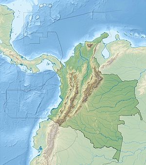
The Peñol-Guatapé reservoir (Spanish Embalse Peñol-Guatapé ) is located in the Department of Antioquia in central Colombia . The reservoir was built to generate electricity. It is also used for leisure and recreation.
Peñol-Guatapé reservoir
The Peñol-Guatapé reservoir is located at an altitude of around 1880 m in the Central Cordillera of Colombia, 44 km east of the city of Medellín . The small town of Guatapé is located on the eastern shore of the lake . The heavily branched reservoir has a maximum length of 15 km. It is located on the upper reaches of the Río Nare , a left tributary of the Río Magdalena . The storage capacity of the reservoir is given as 1070 million cubic meters.
Weir Santa Rita
The Peñol-Guatapé reservoir was created in the late 1960s when the Río Nare was dammed. The Santa Rita weir (Spanish: Vertedero Santa Rita ) ( ⊙ ) is located on the north bank of the reservoir . In the event of a flood , water can be discharged into the usually almost dry river bed of the Río Nare via a flood relief system with a discharge channel .
Guatapé hydropower plant
The operator of the Guatapé hydropower plant (Spanish Central Hidroeléctrica Guatapé ) is Empresas Públicas de Medellín (EPM). The power plant was built in two construction phases with 4 units each. The first phase was completed in 1971/72, the second in 1979.
The water is fed through a pressure tunnel to the cavern power station , which is located 5 km east of the lake about 400 m below the ground. From the Guatapé road to San Rafael , a road branches off to the power plant site and the associated substation ( ⊙ ). The hydropower plant has 8 units, each consisting of a vertical Pelton turbine with an output of 70 MW. The total installed capacity is 560 MW. The average annual electricity production is 2730 GWh.
The power plant uses a fall height of 810 m. Below the power station, the water is fed to the Río Guatapé , which is a tributary of the Río Nare. The discharge point ( ⊙ ) into the Río Guatapé is 4 km west of San Rafael.
Cable fire in February 2016
On February 15, 2016, a 230 kV cable that conducts electricity through a 2.3 km long tunnel from the power station to the substation caught fire due to a technical defect. The power generation of the power plant thus failed. At that time, cables were stored in Mexico that could replace the damaged cables in the Guatapé hydropower plant. Eight transport flights were organized from Mexico City to Rionegro Airport in Colombia to ensure that the cables can be replaced as quickly as possible and that the power plant can be restarted . 57 spools with a total of 30 kilometers of cable were delivered by Antonov An-124-100 transport aircraft. The Mexican government granted EPM the necessary credit to purchase the cables. On June 25, 2016, the power plant finally went back into full operation.
![]() Map with all coordinates: OSM | WikiMap
Map with all coordinates: OSM | WikiMap
See also
Individual evidence
- ↑ a b c d e Sistema de generación de energía de EPM . www.epm.com.co. Retrieved July 13, 2019.
- ↑ a b c EPM stated to operate the Guatape hydroelectric plant today at 100%, 68 days before expected . www.epm.com.co. June 25, 2016.
Web links
- centraleshidroelectricasdeantioquia.blogspot.com
- Reopening of the Guatapé hydroelectric plant in Colombia at www.prysmiangroup.com

