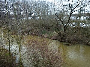
Rötha reservoir
| Rötha reservoir | |||||||||||
|---|---|---|---|---|---|---|---|---|---|---|---|
| The Rötha reservoir, seen to the west | |||||||||||
|
|||||||||||
|
|
|||||||||||
| Coordinates | 51 ° 11 '21 " N , 12 ° 24' 41" E | ||||||||||
| Data on the structure | |||||||||||
| Lock type: | Earthfill dam | ||||||||||
| Construction time: | 1938-1942 | ||||||||||
| Height of the barrier structure : | approx. 2 m | ||||||||||
| Data on the reservoir | |||||||||||
| Water surface | 0.69 km² | ||||||||||
| Reservoir length | 1.01 km | ||||||||||
| Reservoir width | 0.75 km | ||||||||||
| Storage space | 1.33 million m³ | ||||||||||
The Rötha reservoir is a reservoir north-west of Borna and south of Leipzig in Saxony , which was built between 1938 and 1942 as a flood retention basin and service water supplier for the lignite industry in the region. With the progressive expansion of the Witznitz II opencast mine , the southern part was drained and dredged at the end of the 1960s. The northern part was spared this fate due to the early closure of the opencast mine in 1993.
Geographical location
The Rötha reservoir is located in the Leipzig lowland bay south of the eponymous city of Rötha in the Saxon district of Leipzig . In the west is the place Gaulis , in the southeast of the Kahnsdorfer See . The reservoir is fed by a branch from the Pleiße and drained by the Kleine Pleiße . The lake belongs to the natural mining area south of Leipzig and to the Leipziger Neuseenland .
history
The Rötha reservoir is the oldest facility in the Pleiße- Wyhra system . The lake was built between 1938 and 1942 in a flood plain south of Rötha, characterized by orchards and meadows. The dammed water came from the Pleiße. Originally the lake was twice the size. As a result of the ongoing brown coal mining of the Witznitz II opencast mine (construction site 2), the southern part was drained at the end of the 1960s and then dredged over. Between the two parts of the lake, the so-called coal connection line ran on a dam, an operating line to connect the Böhlen and Espenhain lignite works, as well as a footpath. This dam is now the southern boundary of the reservoir.
The lake owes part of its attractiveness to the middle of the 20th century to the fruit wine tavern on its east side, built around 1900 but now dilapidated, and a rowing boat rental station near it.
The northern part, too, would have been over-dredged with the opening of the Gaulis mining field (planned mining time: approx. 1990 to 2015). Due to the early closure of the Witznitz II opencast mine in 1993, the northern part of the Rötha reservoir was spared this fate. After the renaturation of the Witznitz II opencast mine, three residual lakes were created, of which the Hainer See is to be connected to the Rötha reservoir via its drain to the Pleiße and a canal with a lock.
use
In addition to flood protection, the system also served to provide raw water for large companies and power plants in the Espenhain and Böhlen area . Due to its small storage space, however, the lake plays a subordinate role in flood protection.
Due to its location in a protected landscape area, the lake with its attractive hiking trails and water sports facilities is a popular local recreation area. The lake also serves as a fishing spot.
See also
Web links
- History of the Witznitz opencast mine with maps on the LMBV website
- The Rötha reservoir on the Leipziger Neuseenland website
- The Rötha reservoir on www.leipziger-seen.de
Individual evidence
- ↑ Saxony Fishing Atlas. Retrieved May 16, 2019 .


