Steinensittenbach
|
Steinensittenbach
Parish of Kirchensittenbach
Coordinates: 49 ° 35 ′ 35 ″ N , 11 ° 24 ′ 49 ″ E
|
|
|---|---|
| Postal code : | 91241 |
| Area code : | 09151 |
|
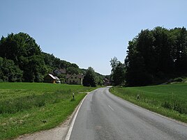
View of Steinensittenbach
|
|
The village of Steinensittenbach (Franconian: Staabo ) is one of 21 districts of the municipality of Kirchensittenbach in the district of Nürnberger Land in Bavaria and is 5.6 kilometers from the main town of the municipality on the 2404 state road between Obermühle and Hormersdorf . The place belongs to the administrative region Middle Franconia , lies at the origin of the Sittenbach and has about 25 originally agricultural properties. In the northwest is the Lammbühl elevation (509 m), in the east the Schwarzenberg (589 m) and the Pfaffenberg and in the southeast the Hohensteiner Berg (595 m) and Hohenstein Castle . It is 2.2 kilometers away.
literature
- Nuremberg country . Karl Pfeiffer's Buchdruckerei und Verlag, Hersbruck 1993, ISBN 3-9800386-5-3 .
Web links
Commons : Steinensittenbach - Collection of images, videos and audio files

