Entmersberg
|
Entmersberg
Parish of Kirchensittenbach
Coordinates: 49 ° 35 ′ 5 ″ N , 11 ° 23 ′ 45 ″ E
|
|
|---|---|
| Postal code : | 91241 |
| Area code : | 09152 |
|
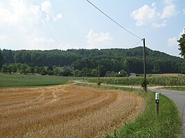
View of Entmersberg
|
|
The hamlet Entmersberg is one of 21 districts of the municipality of Kirchensittenbach in the district of Nürnberger Land in Bavaria .
geography
The place belongs to administrative region of Middle Franconia and lies above the Sittenbach valley, north of Morsbrunn , northwest of Algersdorf east of Osternohe , south of Frohnhof and west of Upper Mill and Hartenstein on the road connecting Algersdorf after Frohnhof. To the east lies the Mühlberg (505 m). The hamlet has five properties and is surrounded by fields, meadows and forests. In the west is the Osternoher Forest.
history
The first mention of "Emtmersberg" can be found in the Ansbach interest register. It is reported that in the 14th and 15th centuries there was a margravial court that was desolate and deserted . Jorg von Wildenstein, who was the bailiff of Osternohe at the time, had left the farm to the “Puchen farmer” Merkel, but Fritz Steinbach is said to have been on the farm for three years at that time. Entmersberg belonged to what was then the municipality of Osternohe until 1920. This year, at the request of the residents, Entmersberg was accepted into the municipality of Algersdorf and thus into the district of Hersbruck . Entmersberg has been part of the municipality of Kirchensittenbach since 1971.
literature
- Entmersberg . Portrait of a village. AMS Verlag, Hersbruck 2008, With texts by Bernd Zachow, Uli Olpp, Dr. Ulrich Maly, Peter P. Kraus, ISBN 978-3-941353-00-8 , publisher Walter Bauer
- Nuremberg country . Karl Pfeiffer's Buchdruckerei und Verlag, Hersbruck 1993, ISBN 3-9800386-5-3 .
Web links
- http://www.kirchensittenbach.de/
- Entry on the coat of arms of Entmersberg in the database of the House of Bavarian History

