Stollenbach (Ruhr)
|
Stollenbach upper course: Limbeck brook |
||
|
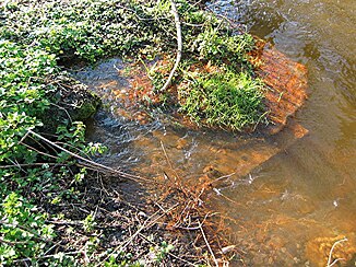
Orifice of the Schlebuscher Erbstollen |
||
| Data | ||
| Water code | DE : 2769134 | |
| location | Wetter (Ruhr) , Ennepe-Ruhr district , Ruhr area , North Rhine-Westphalia , Germany | |
| River system | Rhine | |
| Drain over | Ruhr → Rhine → North Sea | |
| source | as Limbecker Bach 51 ° 21 ′ 20 ″ N , 7 ° 20 ′ 5 ″ E |
|
| Source height | 252 m above sea level NN | |
| muzzle | in the Ruhrwiesen in the Ruhr Coordinates: 51 ° 23 '40 " N , 7 ° 21' 57" E 51 ° 23 '40 " N , 7 ° 21' 57" E |
|
| Mouth height | 81 m above sea level NN | |
| Height difference | 171 m | |
| Bottom slope | 27 ‰ | |
| length | 6.4 km | |
| Catchment area | 7.295 km² | |
The Stollenbach is a left tributary of the Ruhr in the district of Wengern von Wetter (Ruhr) . Its upper part is called Limbecker Bach .
course
It flows along the shaft and the tack room of the Schlebuscher Erbstollen . A few hundred meters further on, the stream takes in the water from the mouth of the Erbstollen. Then it crosses under Oberwengener Straße and flows through the Ruhrwiesen to the Ruhr.
Web links
Commons : Stollenbach (Ruhr) - Collection of images, videos and audio files
Individual evidence
- ↑ a b German basic map 1: 5000
- ↑ a b Topographical Information Management, Cologne District Government, Department GEObasis NRW ( information ) (query on January 10, 2013)
