Stubache
| Stubache | ||
|
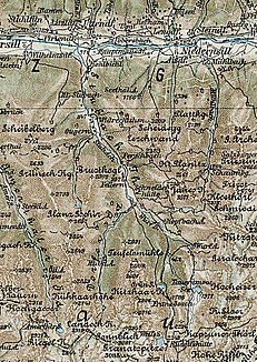
Map section, ca.1900 |
||
| Data | ||
| location | Salzburg , Austria | |
| River system | Salzach | |
| Drain over | Salzach → Inn → Danube → Black Sea | |
| source | Confluence of the Wurfbach and Ödbach rivers 47 ° 12 ′ 18 ″ N , 12 ° 35 ′ 50 ″ E |
|
| Source height | 1000 m | |
| muzzle |
Salzach coordinates: 47 ° 16 ′ 51 ″ N , 12 ° 33 ′ 41 ″ E 47 ° 16 ′ 51 ″ N , 12 ° 33 ′ 41 ″ E
|
|
| length | approx 15 km | |
The Stubache is a right tributary of the Salzach and is created by the confluence of its source waters Wurfbach and Ödbach. It flows from south to north and forms the Stubach Valley . After a length of approx. 15 km it joins the Salzach near Uttendorf . Her name is interpreted as a flying Ache . The river has water quality class II. Its water is used by the Stubachtal power plant group . It is touristy u. a. accessed through the Rudolfshütte .
supporting documents
- ↑ a b limited preview in the Google Book search
photos
Commons : Stubachtal - collection of images, videos and audio files


