Suchá Kamenice
| Suchá Kamenice | ||
|
Mill weir on the lower reaches |
||
| Data | ||
| location | Czech Republic, Elbe Sandstone Mountains | |
| River system | Elbe | |
| Drain over | Elbe → North Sea | |
| source | on the western slope of Bynovecky vrch 50 ° 49 ′ 22 ″ N , 14 ° 16 ′ 56 ″ E |
|
| Source height | 356 m above sea level NHN | |
| muzzle |
Labe bei Hřensko coordinates: 50 ° 51 ′ 47 ″ N , 14 ° 13 ′ 40 ″ E 50 ° 51 ′ 47 ″ N , 14 ° 13 ′ 40 ″ E |
|
| Mouth height | 121 m nm | |
| Height difference | 244 m | |
| Bottom slope | 37 ‰ | |
| length | 6.7 km | |
| Communities | Arnoltice | |
The Suchá Kamenice ( German Dürrkamnitz ) is a right tributary of the Elbe in northern Bohemia , Czech Republic .
geography
The source of the Suchá Kamenice is located on the western slope of the Bynovecky vrch and it flows into the Elbe 1 km above Hřensko (Herrnskretschen). The only place it touches is the municipality of Arnoltice . In the lower reaches the river has cut deeply into the sandstone massif and forms the údolí Suché Kamenice gorge (Dürrkamnitz gorge) with bizarre rock faces. The name is related to the frequent drying up of the river bed, which is clearly visible in the canyon. The water flow is only continuous after periods of precipitation. Nevertheless, there can be considerable devastation after thunderstorms. At the exit of the gorge near the mouth there are several vortex pots and a spring with a heavy discharge and high iron content. It is one of the most productive in the region.
history
In 1793 a mill was built in the lower part of the údolí Suché Kamenice . It was called the goat mill . Because of the water conditions it was a seasonal mill. It served as a grain, saw, and tamper mill. In 1882 it was destroyed by fire and not rebuilt. Since the mill operation alone was not profitable, an inn with a bowling alley and a dance hall was built below it, which lasted until 1945. The mill became a popular travel destination, with its beauty also known artists such. B. Eduard Leonhardi , Ludwig Richter or Bedřich Havránek . In the upper part of the ground under the Krümmerwand in 1848 the Grimmermühle, which has now completely disappeared, was built with a mill pond. In its place there was the Krümmerbaude , a small inn, from 1929 to 1945 . In 1894 the gorge was opened up for tourism by the Mountain Association for Bohemian Switzerland.
Buildings and monuments
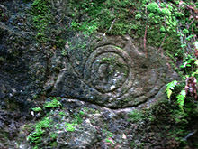
In the lower part of the gorge, a concrete bunker (ear stand) was built in 1938 as part of the Czechoslovak Wall (Czech československé opevnění ). Among the points of interest include among others a rocky bank to the 60th jubilee of Emperor Franz Joseph I. recalls. Two relief panels draw attention to the fact that timber was transported here in 1925. Deep gullies in the ashlars of the sandstone packing of the path also indicate such activities. A post horn carved into a boulder resembles the post stone in the Rakosovy důl ( reed bed ) near Vlčí Hora ( Wolfsberg ).
literature
- Peter Rölke: Hiking & Nature Guide Bohemian Switzerland, Dresden 2007, ISBN 3-934514-07-3
- Ferdinand Thal: Guide through Saxon Switzerland, reprint from 1846, Halle 1991, ISBN 3-910147-13-5
- Information sheet of the National Park Administration Bohemian Switzerland: The area around Hřensko, Krásná Lípa 2005
- Official map of the Bohemian Switzerland National Park, Česká Lípa 2005


