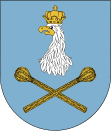
Sulejówek
| Sulejówek | ||
|---|---|---|

|
|
|
| Basic data | ||
| State : | Poland | |
| Voivodeship : | Mazovia | |
| Powiat : | Mińsk Mazowiecki | |
| Area : | 19.31 km² | |
| Geographic location : | 52 ° 15 ' N , 21 ° 17' E | |
| Residents : | 18,656 | |
| Postal code : | 05-070, 05-071 | |
| Telephone code : | (+48) 22 | |
| License plate : | WM | |
| Economy and Transport | ||
| Street : | E 30 | |
| Rail route : | S 2 | |
| Gmina | ||
| Gminatype: | Borough | |
| Residents: | 19,766 (Jun. 30, 2019) |
|
| Community number ( GUS ): | 1412151 | |
| Administration (as of 2014) | ||
| Mayor : | Arkadiusz Śliwa | |
| Address: | ul.Dworcowa 55 05-070 Sulejówek |
|
| Website : | www.sulejowek.pl | |
Sulejówek is a city in Poland in the greater Warsaw area . Sulejówek is located about 18 km from the center of Warsaw and belongs to the powiat Miński in the Masovian Voivodeship .
history
The first written mention of the place took place in 1526 as Sulewo . When Poland was partitioned for the third time in 1795, the village was transferred to Austria, and in 1815 to Congress Poland . At that time the village consisted of 6 residential buildings with 57 residents. In 1939 the place was occupied by the Wehrmacht , on July 31, 1944 the occupation ended with the invasion of the Red Army . On July 18, 1962, Sulejówek, with meanwhile 13,500 inhabitants, received city rights . From 1975 to 1998 the municipality was part of the Warsaw Voivodeship .
Web links
Commons : Sulejówek - collection of images, videos and audio files
- Official website of the city (Polish)
- map
Individual evidence
- ↑ population. Size and Structure by Territorial Division. As of June 30, 2019. Główny Urząd Statystyczny (GUS) (PDF files; 0.99 MiB), accessed December 24, 2019 .
- ↑ a b c Website of the city of Sulejówek, Historia miasta - Kalendarium , accessed on June 12, 2014
- ↑ Dz.U. 1975 no 17 poz. 92 (Polish) (PDF file; 783 kB)
