
Sulop
| Municipality of Sulop | |||
| Location of Sulop in the Davao del Sur province | |||
|---|---|---|---|

|
|||
| Basic data | |||
| Region : | Davao region | ||
| Province : | Davao del Sur | ||
| Barangays : | 25th | ||
| District: | 2. District of Davao del Sur | ||
| PSGC : | 112414000 | ||
| Income class : | 6th income bracket | ||
| Households : | 5800 May 1, 2000 census
|
||
| Population : | 33,613 August 1, 2015 census
|
||
| Coordinates : | 6 ° 36 ′ N , 125 ° 21 ′ E | ||
| Postal code : | 8009 | ||
| Mayor : | Jose Jimmy S. Sagarino | ||
| Geographical location in the Philippines | |||
|
|||

Sulop is a Filipino municipality in the province of Davao del Sur on the island of Mindanao . It has 33,613 inhabitants (August 1, 2015 census).
Barangays
Sulop is politically in 25 barangays divided.
|
|
geography
The place is located on the eastern coast of the Davao del Sur province on the Gulf of Davao in the Padada Valley. The place is located south of a hilly landscape that extends at the foot of Mount Apo .
economy
In Sulop, agriculture is a key factor. Rice , abacá , wheat , sugar cane , bananas , mangos and coconuts are grown in the local area .
The districts along the coastline live mainly from fishing. The biodiversity in the fish-rich Gulf of Davao ensures the livelihood of numerous families.
climate
The rainiest months are December, January and February. The months of April, June and July, on the other hand, are rather dry. Even so, rainfall can occur all year round.
Location views
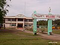
Municipal Hall

Commercial street

IFI Church in Sulop


