Sun River
|
Sun River Medicine River |
||
|
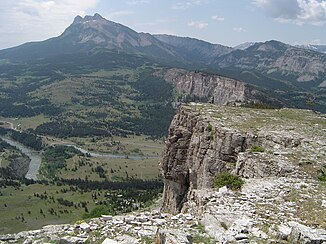
View of the Sun River at the base of the Rocky Mountains |
||
| Data | ||
| Water code | US : 802208 | |
| location | Montana (USA) | |
| River system | Mississippi River | |
| Drain over | Missouri → Mississippi → Gulf of Mexico | |
| Confluence of |
North Fork and South Fork Sun River 47 ° 37 ′ 47 ″ N , 112 ° 51 ′ 25 ″ W |
|
| Source height | 1441 m | |
| muzzle | at Great Falls in the Missouri River Coordinates: 47 ° 29 ′ 42 " N , 111 ° 18 ′ 43" W 47 ° 29 ′ 42 " N , 111 ° 18 ′ 43" W |
|
| Mouth height | 1010 m | |
| Height difference | 431 m | |
| Bottom slope | 2.1 ‰ | |
| length | 209 km | |
| Catchment area | 4856 km² | |
| Discharge at the gauge Vaughn A Eo : 4593 km² Location: 23 km above the mouth |
MQ 1935/2016 Mq 1935/2016 |
18.8 m³ / s 4.1 l / (s km²) |
| Reservoirs flowed through | Gibson Reservoir | |
| Medium-sized cities | Great Falls | |
| Communities | Simms, Sun River, Vaughn | |
|
Location of the Sun River in the Missouri River system |
||
|
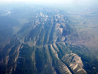
Gibson Reservoir and Sun River in the Rocky Mountain Front |
||
The Sun River (also Medicine River ) is a left tributary of the Missouri River in the US state of Montana .
The Sun River is 209 km long and is formed by the confluence of its headwaters North Fork and South Fork Sun Rivers in the Rocky Mountains . The Sun River cuts the Rocky Mountain Front to the east. It is dammed from the Gibson Dam to the Gibson reservoir . Below the Gibson Dam is a diversion dam , where part of the river water is diverted through an irrigation canal to Pishkun Reservoir and a smaller part through the Willow Creek Feeder Canal . The Sun River flows through the Great Plains in a predominantly easterly direction. It passes the villages of Simms , Sun River and Vaughn , before flowing into the Missouri River at Great Falls .
Web links
Individual evidence
- ^ North Fork Sun River in the Geographic Names Information System of the United States Geological Survey
- ↑ South Fork Sun River in the Geographic Names Information System of the United States Geological Survey
- ^ A b Sun River in the Geographic Names Information System of the United States Geological Survey
- ↑ USGS 06089000 Sun River near Vaughn MT


