Swydivets
| Swydivets | ||
|---|---|---|
|
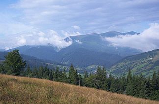
View of the Swydivets Mountains |
||
| Highest peak | Blyznytsia ( 1883 m ) | |
| location | Ukraine | |
| part of | Outer Eastern Carpathians | |
|
|
||
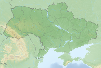
| Coordinates | 48 ° 16 ' N , 24 ° 12' E | |
| rock | Flysch | |
The Swydiwez (Ukrainian Свидівець ; Russian Свидовец / Swidowez ; Polish Świdowiec ; Czech and Slovak Svidovec ) is a mountain range in western Ukraine .
The mountain range is part of the Forest Carpathians and is located in the Outer Eastern Carpathians in the east of the Transcarpathian Oblast and connects to the Gorgany and Tschornohora mountains to the west . The highest elevations include:
- Blyznytsja ( Близниця - 1883 m )
- Strymtscheska ( Стримческа - 1872 m )
- Tataruka ( Татарука - 1774 m )
- Dohjaska ( Догяска - 1764 m )
- Unharjaska ( Унгаряска - 1707 m )
On the mountain range there are parts of the primeval beech forests of the Carpathians . The forests are threatened by illegal logging and a planned tourism project, which would have negative consequences for the ecosystem .
Web links
Commons : Swydiwez - collection of images, videos and audio files
- Information about the mountain range (Ukrainian)
- Czechoslovak hiking map of the area ( Memento from February 21, 2007 in the Internet Archive )
- Website of the environmental group Free Svydovets
Individual evidence
- ↑ Gigantic ski tourism project. Retrieved June 11, 2018 .
- ↑ The long battle for Svydovets. Retrieved June 11, 2018 .
- ↑ Free Svydovets. Retrieved June 11, 2018 .


