
Tadjoura (region)
| تاجورة Tadjoura
|
|
|---|---|
  |
|
| Basic data | |
| Country | Djibouti |
| Capital | Tadjoura |
| surface | 7300 km² |
| Residents | 87,000 (2009 census) |
| density | 12 inhabitants per km² |
| ISO 3166-2 | DJ-TA |
Coordinates: 11 ° 47 ' N , 42 ° 36' E
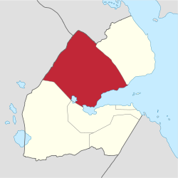
Tadjoura (also written Tadjourah or Tajura , Arabic تاجورة Tajura , DMG Taǧūra ) is a region in northern Djibouti . The capital of the region is the city of the same name, Tadjoura, with 22,000 inhabitants. Other larger places are Randa , Dorra and Balho . The Tadjoura region has about 87,000 inhabitants.
The region borders in the north and northwest on Ethiopia and Eritrea , in the northeast on the Obock region , in the south on Dikhil and Arta and in the southeast on the Gulf of Tadjoura . The Assalsee is located in the south of the region. In the triangle between Djibouti, Eritrea and Ethiopia lies the Mousa Ali , with 2028 m the highest point in Djibouti. The Forêt du Day is the only forest in all of Djibouti.