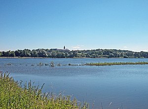
Döllnitzsee dam
| Döllnitzsee dam | |||||||||
|---|---|---|---|---|---|---|---|---|---|
| Döllnitzsee with Hubertusburg Castle | |||||||||
|
|||||||||
|
|
|||||||||
| Coordinates | 51 ° 15 ′ 58 " N , 12 ° 56 ′ 30" E | ||||||||
| Data on the structure | |||||||||
| Construction time: | 1850 | ||||||||
| Height above valley floor: | 8.4 m | ||||||||
| Height of the structure crown: | 167.06 m | ||||||||
| Crown length: | 360 m | ||||||||
| Crown width: | 3 m | ||||||||
| Data on the reservoir | |||||||||
| Water surface | 48 ha | ||||||||
| Storage space | 3.22 million m³ | ||||||||
The Döllnitzsee dam (also called Wermsdorf or Laubethal ) is a dam in Saxony , which was built in 1850 southwest of Wermsdorf and reconstructed in 1981–1983. It is part of the Wermsdorf Lakes .
The dam and its two barrages , theHorstsee (72 ha) and the Göttwitzsee (80 ha) are used for the supply of industrial water , for flood protection , for fishing and for recreation . The barrier structure of the Döllnitzsee dam and the pre- dams are earth dams . At the main dam there is a large, elongated overflow funnel as flood relief . The dammed waters are the Döllnitz and the Saubach.
The reservoir is located on the watershed between the Elbe and Mulde . That is why the water from the Horstsee not only flows to the Döllnitz and the Elbe, but also to the Mulde via the Saubach and Mutzschener Wasser .
For some of the data mentioned in the table (construction times, height, content and area) there is also different information.


