Monticello dam
| Monticello dam | ||
|---|---|---|
| location | ||
|
|
||
| Coordinates | 38 ° 30 '49 " N , 122 ° 6' 17" W | |
| country |
|
|
| place | Napa County , California | |
| Waters | Putah Creek | |
| Height upstream | 138.5 m | |
| power plant | ||
| owner | Solano Irrigation District (SID) | |
| operator | SID | |
| construction time | 1981 to 1983 | |
| Start of operation | 1983 | |
| technology | ||
| Bottleneck performance | 11.5 megawatts | |
| Standard work capacity | 66.7 million kWh / year | |
| Turbines | 2 × 5 MW, 1 × 1.5 MW | |
| Others | ||
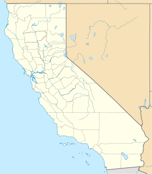
The dam Monticello ( English Monticello Dam ) is a dam with hydroelectric plant in Napa County , State of California , USA . It dams the Putah Creek to the reservoir Lake Berryessa . The dam and reservoir are in the Vaca Mountains , part of the northern California Coast Mountains .
The dam is primarily used for irrigation and drinking water supply. Construction of the dam began in 1953. It was completed in 1957. The dam is owned by the United States Bureau of Reclamation (USBR) and is also operated by the USBR. The associated power plant was built from 1981 to 1983. It is owned and operated by the Solano Irrigation District (SID).
Barrier structure

The shut-off is an arch dam of concrete with a height of 92.5 m (304 ft ) above the foundation bed . The top of the wall is at a height of 139 m (456 ft) above sea level . The length of the top of the wall is 312 m (1023 ft). The thickness of the dam is 30.5 m (100 ft) at the base and 3.5 m (12 ft) at the top. The volume of the structure is 249,245 m³ (326,000 cubic yards ).
The inlet of the spillway consists of a robbery funnel (Engl. Morning Glory Spillway or Glory Hole ), which is located on the right bank. The diameter of the funnel at the inlet is 22 m; as the shaft progresses, the diameter of the shaft decreases to 8.5 m (28 ft). The shaft initially leads 75 m into the depth. Then it goes into a horizontal tunnel, which drains the water after another 610 m into Putah Creek. A maximum of 1359 m³ / s (48,000 cft / s) can be discharged via the flood discharge, and a maximum of 73 m³ / s (2580 cft / s) via the bottom outlet .
In 1997 a swimmer got too close to the funnel. She was pulled into the shaft by the strong suction, where she drowned.
Reservoir
With the normal storage target of 138.5 m (455 ft), the reservoir extends over an area of around 80.93 km² (20,000 acres ) and holds 1.97 billion m³ (1.6 million acre-feet ) of water. The reservoir has a length of 37 km (23 miles ) and a maximum width of 4.8 km (3 miles).
power plant
The power plant is located at the foot of the dam. The installed capacity is 11.5 MW . Two turbines have a maximum output of 5 MW each, and another 1.5 MW. The annual production in 2006 was around 66.7 million kWh .
The Solano Irrigation District (SID) began planning to build a hydropower plant in 1975. Approval was granted in 1981. Construction of the power plant began in the same year. It went into operation in March 1983.
See also
Web links
Individual evidence
- ^ Solano Project. United States Bureau of Reclamation (USBR), accessed November 24, 2018 .
- ↑ a b c d Monticello Dam. USBR, accessed November 24, 2018 .
- ↑ a b See Mammoth 'Hole' Open In This Lake. National Geographic Society , February 23, 2017, accessed November 24, 2018 .
- ↑ a b This spectacular photo is a rarity. Die Welt , February 21, 2017, accessed November 24, 2018 .
- ↑ a b c Lake Berryessa, California. berryessa.uslakes.info, accessed November 24, 2018 .
- ^ Monticello Dam and its Morning Glory Spillway. USBR, accessed November 24, 2018 .
- ↑ a b Lake Berryessa. USBR, accessed November 24, 2018 .
- ^ Monticello Hydro Power Plant CA USA. Global Energy Observatory, accessed November 24, 2018 .
- ↑ Power. (PDF) Solano Irrigation District (SID), November 16, 2016, p. 9 , accessed on November 24, 2018 (English).

