Tamar (England)
|
Tamar Dowr Tamer |
||
|
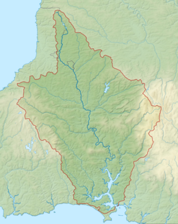
Catchment area of the Tamar |
||
| Data | ||
| location | Devon , Cornwall (Great Britain) | |
| River system | Hamoaze | |
| Drain over | Hamoaze → English Channel | |
| source | near East Youlstone, 50 ° 54 '50 " N , 4 ° 27' 10" W. |
|
| muzzle | in the Hamoaze coordinates: 50 ° 21 ′ 30 " N , 4 ° 10 ′ 0" W 50 ° 21 ′ 30 " N , 4 ° 10 ′ 0" W
|
|
| Runoff at the Gunnislake gauge |
MQ |
22.55 m³ / s |
| Flowing lakes | Upper Tamar Lake , Lower Tamar Lake | |
|
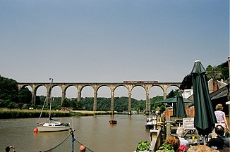
The Calstock Viaduct |
||
The Tamar ( Cornish : Dowr Tamer ) is a river in the south-west of England . Much of it forms the border between Devon and Cornwall . The Tamar flows northwest of Plymouth , together with the River Tavy in the Hamoaze . The Hamoaze merges into Plymouth Sound after a few kilometers between Devil's Point and Mount Edgcumbe .
The river has its source about 4 miles off the north Cornish coast, near East Youlstone . Also in the north, the Tamar flows through Upper Tamar Lake and Lower Tamar Lake , near Alfardisworthy . In contrast to other European rivers, the Tamar has hardly been artificially developed and has been able to retain most of its natural river bed. For this reason, the Lower Tamar Valley area was declared an Area of Outstanding Natural Beauty in 1995 .

