Tambo (Queensland)
| Tambo | |||||||
|---|---|---|---|---|---|---|---|
|
|||||||
|
|||||||
|
|||||||
|
|||||||
|
|
|||||||
[[Category: Place in Queensland ]]
Tambo is a small town in the Blackall-Tambo region in the Australian state of Queensland with around 300 inhabitants (as of 2016).
geography
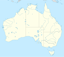
Tambo is located about 100 km southeast of Blackall and about 850 kilometers northeast of Brisbane . It is on the Barcoo River and connects to the Landsborough Highway .
history
Before the arrival of the Europeans, various Aboriginal tribes lived in the area around Tambo . The name can also be traced back to a word in an Aboriginal language, which translated means hidden place .
As early as 1846, the region around today's Tambo was explored by Thomas Livingstone Mitchell . In 1863, Tambo was the first city to be founded in West Queensland.
In 1927, a Qantas Airways aircraft crashed for the first time near Tambo, with fatal consequences. All three inmates were killed in the crash.
economy
Livestock farming and tourism are the main sources of income today. The city is best known for the production of Tambo teddies.
Web links
Individual evidence
- ↑ a b Australian Bureau of Statistics : Tambo ( English ) In: 2016 Census QuickStats . June 27, 2017. Retrieved April 15, 2020.
- ↑ http://espace.library.uq.edu.au/eserv/UQ:212639/s00855804_1961_1962_6_4_779.pdf
- ↑ http://www.waymarking.com/waymarks/WMC4MD_Qantas_DH9C_Crash_site_Tambo_Queensland_Australia
