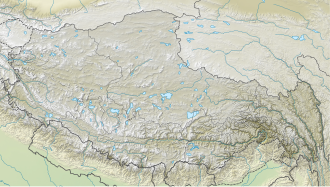
Tanggula Pass
| Tanggula Pass | |||
|---|---|---|---|
|
|
|||
| Compass direction | North | south | |
| Pass height | 5231 m | ||
| region | Qinghai Province | Tibet Autonomous Region | |
| expansion | Lhasa Railway , China National Highway 109 | ||
| Mountains | Tanggula Mountains | ||
| map | |||
|
|
|||
| Coordinates | 33 ° 0 '19 " N , 91 ° 38' 57" E | ||
The Tanggula Pass (officially also: Dang La ; Tibetan : གདང་ ལ་ , Wylie : gdang la ; Chinese 唐古拉山 口 , Pinyin Tánggǔlā shānkǒu ) is a mountain range in the highlands of Tibet that rises to an altitude of 5220 m above sea level . On August 24, 2005 the tracks of the of were here Golmud to Lhasa runs Qinghai-Tibet Railway put, it is the location, the highest railway in the world. It exceeds the highest Peruvian railway line by 255 m. Tangula station, at an altitude of 5068 m , has two platforms, but it is not possible to get on and off.
Between 1912 and 1950 the pass and the mountain range of the same name formed the northern and northeastern border of the immediate sphere of influence of the Tibetan administration ruling in Lhasa.
The road connection National Road 109 overcomes the Tanggula Mountains about 29 kilometers southeast of here, at (32,877 N; 91,916 E) , at an altitude of 5240 m .
climate
|
Monthly average temperatures and rainfall for Tanggula Pass
Source: missing
|
||||||||||||||||||||||||||||||||||||||||||||||||||||||||||||||||||||||||||||||||||||||||||

