Teberda (river)
|
Teberda Теберда́ |
||
|
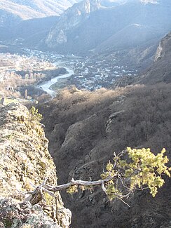
Teberda near Karachayevsk |
||
| Data | ||
| location | Karachay-Cherkessia ( Russia ) | |
| River system | Kuban | |
| Drain over | Kuban → Black Sea | |
| Confluence of |
Gonachchir and Amanaus in the Greater Caucasus 43 ° 20 ′ 8 ″ N , 41 ° 39 ′ 59 ″ E |
|
| muzzle |
Kuban , in Karachayevsk coordinates: 43 ° 46 ′ 38 " N , 41 ° 55 ′ 0" E 43 ° 46 ′ 38 " N , 41 ° 55 ′ 0" E
|
|
| length | 60 km | |
| Catchment area | 1080 km² | |
| Outflow location: 45 km above the mouth |
MQ |
27.2 m³ / s |
| Medium-sized cities | Karachayevsk | |
| Small towns | Teberda | |
|
The Teberda flows into the Kuban |
||
|
Location of the Teberda (Теберда́) in the catchment area of the Kuban |
||
|
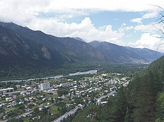
The city of Teberda, in the background the river of the same name |
||
The Teberda ( Russian Теберда́ ) is a left tributary of the Kuban in the Republic of Karachay-Cherkessia in the North Caucasus .
The Teberda arises at the confluence of the Gonachchir and Amanaus , 5 km north of Dombai , on the northern flank of the Greater Caucasus . The 60 km long river flows in a north-northeast direction past the town of the same name Teberda to Karachayevsk , where it meets the upper reaches of the Kuban. The Teberda drains an area of 1080 km². The mean discharge 45 km above the mouth is 27.2 m³ / s. The Teberda is a typical mountain river. There is a lot of rubble in the river bed.
Web links
Individual evidence
- ↑ a b c Article Teberda in the Great Soviet Encyclopedia (BSE) , 3rd edition 1969–1978 (Russian)


