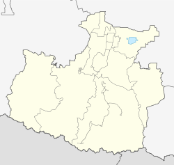
Teberda
city
|
||||||||||||||||||||||||||||||||||
|
||||||||||||||||||||||||||||||||||
|
||||||||||||||||||||||||||||||||||
| List of cities in Russia | ||||||||||||||||||||||||||||||||||
Teberda ( Russian Теберда ) is a small town in the North Caucasian Republic of Karachay-Cherkessia in Russia with 9058 inhabitants (as of October 14, 2010).
geography
The city is located in the Greater Caucasus about 100 km south of the republic capital Cherkessk on the Teberda river of the same name , a left tributary of the Kuban . The city center is at an altitude of about 1300 meters. This makes Teberda the highest city in Russia. The secondary ridges of the main Caucasus ridge surrounding the place reach heights of 3746 m ( Malaja Marka ) and 3822 m ( Kyschkadscher ) in this area . Dombai-Ulgen , located south-east of the district of Dombai on the border with Georgia , is the westernmost four-thousand-meter peak in the Caucasus at 4046 m .
Teberda is administratively subordinate to the city of Karachayevsk .
The town lies on the old Suchumer high road , high above the 2781 meters Kluchoripass the Abkhaz Sukhumi leads (for cars difficult to pass, blocked since the conflict 1992/93).
history
The place was established in 1868 as a Karachay settlement, named after the Baitschoraly-Kabak clan who lived in it .
The first private country houses of wealthy Russians were built at the beginning of the 20th century, the first of which was converted into a tuberculosis sanatorium in 1925 . In the years that followed, a larger number of sanatoriums were built and the village was expanded into a health resort , which in 1929 was given the status of an urban-type settlement under its current name (after the river) .
This development continued after the Second World War , when sanatoriums such as Gornoje uschtschelje ( mountain gorge ), Kluchori , the Teberda and Dombai hotels and the Asgek mountain sports base were built up into the 1970s . This made Teberda - next to the upper Baksantal southwest of the Elbrus (Terskol, Asau) - the most important tourist center of the Soviet Union in the central part of the Caucasus.
In 1971 the settlement was granted city rights.
Population development
| year | Residents |
|---|---|
| 1939 | 3211 |
| 1959 | 4433 |
| 1970 | 6524 |
| 1979 | 6637 |
| 1989 | 8840 |
| 2002 | 7827 |
| 2010 | 9058 |
Note: census data
Culture and sights
The main attraction is the high mountain landscape surrounding the place. South of the city extends the Teberda nature reserve , originally established in 1936 , today around 85,000 hectares in size, a biosphere reserve and since 1994 holder of the European Diploma for Protected Areas . The nature reserve is, however, in sections threatened by the development of tourism, particularly alpine skiing. The administration of the area is in Teberda.
In Teberda there is a museum about the history of the place and the tourism and mountain sports in this area, as well as a mineralogical museum.
economy
Teberda is a mountain sports and alpine ski center as well as a climatic health resort .
Web links
- Teberda on the Karachay-Cherkess tourism portal (Russian)
- Entry on mojgorod.ru (Russian)
Individual evidence
- ↑ a b Itogi Vserossijskoj perepisi naselenija 2010 goda. Tom 1. Čislennostʹ i razmeščenie naselenija (Results of the All-Russian Census 2010. Volume 1. Number and distribution of the population). Tables 5 , pp. 12-209; 11 , pp. 312–979 (download from the website of the Federal Service for State Statistics of the Russian Federation)


