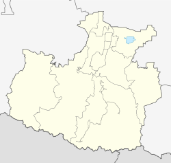
Pregradnaja
Staniza
|
||||||||||||||||||||||||||||||
|
||||||||||||||||||||||||||||||
|
||||||||||||||||||||||||||||||
Pregradnaja ( Russian Преградная , Kabardian Преграднэ / Pregradne , Karachay-Balkar Преградни / Pregradni ) is a Staniza in the Republic of Karachay-Cherkessia ( Russia ) with 7466 inhabitants (as of 14 October 2010).
geography
The Stanitsa is located in the northern part of the Greater Caucasus , between the Skalisty ridge ("rock ridge"), which rises north of the place to almost 1900 m above sea level, and the 40 km further south, upstream of the main ridge and more than 3000 m high Abischira-Achuba ridge. The Urup flows through the town, located about 75 km as the crow flies southwest of the republic capital Cherkessk ; most of the place is on the left bank of the river. A little south of the Stanitsa on the right bank of the Urup is the mining settlement of Mednogorski .
Pregradnaja is the administrative center of the Rajons Urupski and seat of the rural community Pregradnenskoje selskoje posselenije, which also includes the hamlet about four kilometers north to (Khutor) belongs Bolshevik.
history
The Stanitsa was built during the Caucasus War between April and the end of 1860 in the course of the advanced Caucasian line and settled with Cossacks . The term from Russian pregrada stands for "protective wall". The Stanitsa initially belonged to the department (Otdel) Batalpaschinsk of the Kuban Oblast .
After various administrative changes, Pregradnaja became the seat of a newly formed rajon on September 7, 1938, named after her as Pregradnenski rajon . In connection with the deportation of the entire karatschaischen population and the dissolution of Karatschaischen Autonomous Oblast on 12 October 1943, the Raion was disbanded, but recovered after the return of Karachay in January 1957th On February 1, 1963, the Rajon in Urupski promyschlenny rajon ("Urup-Industrie-Rajon") was renamed, and on January 12, 1965 it was finally given the current name (after the river).
Population development
| year | Residents |
|---|---|
| 1897 | 2554 |
| 1939 | 4583 |
| 1959 | 6397 |
| 1970 | 7564 |
| 1979 | 7341 |
| 1989 | 6853 |
| 2002 | 6566 |
| 2010 | 7466 |
Note: census data
traffic
Pregradnaja is located on the Maikop - Karachayevsk regional road that crosses the Urup , formerly known as the R256, today marked 91K-006 on the Karachay-Cherkessian territory. There is no continuous road down the Urup; A road branching off east of Pregradnaja leads upstream via Mednogorski to the village of Urup .
The nearest train station is 40 km northwest of Schedok near Psebai , already in the Krasnodar region , the end point of a branch line from Kurganinsk .
Web links
Individual evidence
- ↑ a b Itogi Vserossijskoj perepisi naselenija 2010 goda. Tom 1. Čislennostʹ i razmeščenie naselenija (Results of the All-Russian Census 2010. Volume 1. Number and distribution of the population). Tables 5 , pp. 12-209; 11 , pp. 312–979 (download from the website of the Federal Service for State Statistics of the Russian Federation)

