Urup (place)
| Village
Urup
Уруп
|
||||||||||||||||||||||||||||
|
||||||||||||||||||||||||||||
|
||||||||||||||||||||||||||||
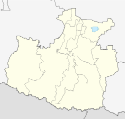
Urup ( Russian Уруп ) is a village (selo) in the raion of the same name in the autonomous republic of Karachay-Cherkessia in the Russian Federation . It has 1530 inhabitants (as of October 14, 2010) and is located on the northern flank of the Greater Caucasus on the Urup River , about 120 kilometers southwest of Cherkessk .
The village is the only settlement in the rural municipality of Urupskoje selskoje posselenije.
history
The place arose before the Second World War as a gold prospecting settlement . Copper ore deposits were discovered in the 1950s , on the basis of which a mine and a processing plant were built. In 1958 the place received the status of an urban-type settlement . The mining operations began operating between 1968 and 1971.
After production at the mine was cut back in the 1980s due to exhaustion of the ore reserves, many residents left the place, which was downgraded to a village again in 1997.
Population development
| year | Residents |
|---|---|
| 1959 | 2220 |
| 1970 | 4495 |
| 1979 | 5817 |
| 1989 | 1390 |
| 2010 | 1530 |
Note: census data
economy
Local companies are the copper mine and the enrichment factory (Urupski GOK). They have been controlled by the Uralskaja Gorno-Metallurgitscheskaja Kompanija (UGMK) since the 1990s , which plans to expand production again on the basis of newly explored ore deposits. Since the 1980s, however, mining activities have concentrated on the facilities at the Mednogorski settlement around 10 km north (downstream) .
Individual evidence
- ↑ a b Itogi Vserossijskoj perepisi naselenija 2010 goda. Tom 1. Čislennostʹ i razmeščenie naselenija (Results of the All-Russian Census 2010. Volume 1. Number and distribution of the population). Tables 5 , pp. 12-209; 11 , pp. 312–979 (download from the website of the Federal Service for State Statistics of the Russian Federation)
- ↑ Article Urup in the Great Soviet Encyclopedia (BSE) , 3rd edition 1969–1978 (Russian)
- ↑ a b Urupski GOK on the UGMK website (Russian)

