Psebai
| Urban-type settlement
Psebai
Псебай
|
||||||||||||||||||||||||||||||||||||
|
||||||||||||||||||||||||||||||||||||
|
||||||||||||||||||||||||||||||||||||
| List of large settlements in Russia | ||||||||||||||||||||||||||||||||||||
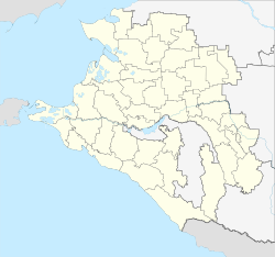
Psebai ( Russian Псеба́й ) is an urban-type settlement in the Krasnodar region ( Russia ) with 10,839 inhabitants (as of October 14, 2010).
geography
The settlement is located on the northern flank of the Greater Caucasus about 180 km southeast of the regional administration center Krasnodar on the left bank of the Little Laba (Malaya Laba), which joins the Big Laba (Bolshaya Laba) about 20 km to the north to form the Kuban tributary Laba . In the vicinity of the village, the mountains rise to 1200 to 1300 m above sea level. Staniza Andrjuki is on the opposite, right bank .
Psebai belongs to the Mostowskoi Rajons and is located 30 km south of the Mostowskoi administrative center . The settlement is the administrative seat of the municipality of the same name (gorodskoje posselenije), which also includes the four rural settlements Burny (about 12 km south of the center of Psebai), Kirowski (20 km south), Nikitino (17 km south) and Perewalka (7 km south ) belong, all upstream on the Little Laba.
history
A Russian settlement with the name Psebaiskoje, after the left arm of the Little Laba called Psebaika, was built in the area of today's settlement during the Caucasus War of 1817–1864 in 1857; a church was built the following year. In 1862 Cossack families from the Stanitsa Novopokrowskaya were settled in order to create a fortification on the border line to the settlement area of the local mountain people. In 1873 the place received the status of a Stanitsa under the name Psebaiskaya.
Not later than 1938 the place became a village (selo) called Psebai. During the Second World War , the place was occupied by the German Wehrmacht from the summer of 1942 to the beginning of 1943 . From 1944 to 1962 it was the administrative seat of a Rajon of the same name . In 1958 the village was united with the downstream settlements Gipsowy Zavod ("Gypsum Works") and Schelesnodoroschny and received the status of an urban-type settlement.
Population development
| year | Residents |
|---|---|
| 1897 | 3,391 |
| 1939 | 5,187 |
| 1959 | 14,152 |
| 1970 | 10,907 |
| 1979 | 9,879 |
| 1989 | 11.207 |
| 2002 | 11,031 |
| 2010 | 10,839 |
Note: census data
Attractions
Psebai is one of the starting points for a visit to the central parts of the western Caucasus as well as the upstream "rocky ridge" (Skalisty chrebet). South of the village, in the area of the upper reaches of the Little Laba and its tributaries, part of the Caucasus nature reserve extends .
Economy and Infrastructure
The largest company is the Kubanski gips plant, owned by the German Knauf Gips KG. There are also forestry companies.
Psebai is the end of a nearly 100 km long railway line that branches off from the Armavir - Tuapse line in Kurganinsk ( Kurgannaja station ) . For the last 10 km from Schedok in the north to the Psebai plasterworks, it is used exclusively for freight traffic. The line was opened in 1915 to Labinsk ( Labinskaya station ), in 1951 to its end point. A narrow-gauge railway leading from Psebai to Kurdschinowo in the valley of the Great Laba, which runs further to the east, was shut down in the 1980s. In the lower part of the village, the Little Laba is crossed by the regional road R256, which , coming from the capital of the Republic of Adygeja Maikop , continues via Zelenchukskaya to Karachayevsk in the Republic of Karachay-Cherkessia .
Individual evidence
- ↑ a b Itogi Vserossijskoj perepisi naselenija 2010 goda. Tom 1. Čislennostʹ i razmeščenie naselenija (Results of the All-Russian Census 2010. Volume 1. Number and distribution of the population). Tables 5 , pp. 12-209; 11 , pp. 312–979 (download from the website of the Federal Service for State Statistics of the Russian Federation)


