Akhtyrski
| Urban-type settlement
Achtyrski
Ахтырский
|
||||||||||||||||||||||||||||||||||||||||
|
||||||||||||||||||||||||||||||||||||||||
|
||||||||||||||||||||||||||||||||||||||||
| List of large settlements in Russia | ||||||||||||||||||||||||||||||||||||||||
Akhtyrski ( Russian Ахтырский ) is an urban-type settlement in the Krasnodar Territory ( Russia ) with 20,100 inhabitants (as of October 14, 2010).
geography
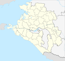
The settlement is located on the edge of the forested foothills of the western part of the Greater Caucasus , which gradually rise to a height of 500 m south of the village , almost 60 kilometers as the crow flies west-southwest of the regional administrative center of Krasnodar . The Akhtyr, a left tributary of the Chabl, which flows into the Kuban, flows through the village .
Akhtyrski belongs to Abinsk Rajon and is ten kilometers east of its administrative center Abinsk .
history
In place of today's settlement, a stanitsa was built in 1863 when Cossacks were settled in the final phase of the Caucasus War (1817–1864) in order to strengthen Russian positions in the area . The first settlers came from already existing stanizi in the region and the governorates of Poltava and Kharkov . The Stanitsa received the name Antchyrskaja after the original name of the river Antchyr . In 1867 the name was changed to Akhtyrskaja in order to make its origin from the "languages of the mountain peoples" ( Adygean there ) less obvious, also as an adaptation to Russian pronunciation habits and based on the name of the city Akhtyrka in the Charkov governorate (today Ukrainian Ochtyrka in the Sumy Oblast ).
Shortly before the beginning of the Second World War , oil and natural gas deposits were discovered in the area of Staniza from 1938 , which indicated a change in the previously agricultural character of the place. This development was stopped by the beginning of the war. Akhtyrskaja was taken by the German Wehrmacht on August 17, 1942 during the summer offensive (" Fall Blau ") . The reconquest by the Red Army took place on February 22, 1943.
In 1948 the construction of an oil workers' settlement began, which was initially independent and in 1952 received the status of an urban-type settlement under the name Akhtyrski . With a resolution of September 22, 1958, the workers' settlement and Stanitsa and the nearby village of Dubrawinski were merged under their current name and status.
Population development
| year | Residents |
|---|---|
| 1939 | 5,225 |
| 1959 | 15,691 |
| 1970 | 18,170 |
| 1979 | 18,341 |
| 1989 | 18,568 |
| 2002 | 19,219 |
| 2010 | 20,100 |
Note: census data
Economy and Infrastructure
After the oil reserves in the Akhtyrski area have been largely exhausted since the 1980s, the settlement is now again primarily the center of an agricultural area.
The settlement is on the of the North Caucasian railway operated, 1888 opened on this section in 1994 and throughout the year 2000 electrified railway Tikhoretskaya - Krasnodar - Krymskaja - Novorossiysk (Station Name Achtyrskaja ; 729 kilometer from Volgograd ). To the south, the Stanitsa is bypassed by the A146 trunk road, which connects the M4 at Krasnodar with the M25 and represents an alternative route to the Black Sea port of Novorossiysk.
Individual evidence
- ↑ a b Itogi Vserossijskoj perepisi naselenija 2010 goda. Tom 1. Čislennostʹ i razmeščenie naselenija (Results of the All-Russian Census 2010. Volume 1. Number and distribution of the population). Tables 5 , pp. 12-209; 11 , pp. 312–979 (download from the website of the Federal Service for State Statistics of the Russian Federation)
- ↑ Sergei Samovtor: Otraženie kazač'ej kolonizacii v toponimii Kubani . Dissertation. Stavropol 2008 ( The reflection of the processes of Cossack colonization in the toponymy of the Kuban area ; online , Word document, Russian).
Web links
- Official website of Akhtyrsky Municipality Administration (Russian)


