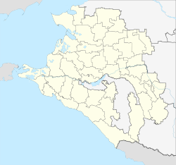
Belaya Glina
| Village
Belaya Glina
Белая Глина
|
||||||||||||||||||||||||||||||||||||
|
||||||||||||||||||||||||||||||||||||
|
||||||||||||||||||||||||||||||||||||
| List of large settlements in Russia | ||||||||||||||||||||||||||||||||||||
Belaja Glina ( Russian Бе́лая Гли́на ) is a village in the Krasnodar region ( Russia ) with 17,320 inhabitants (as of October 14, 2010).
geography
The place is located in the northeastern Kuban area in the foothills of the Caucasus , about 190 kilometers as the crow flies northeast of the regional administrative center Krasnodar on the Rassypnaja river, into which the Mekleta flows a little below. The Rassypnaja is a tributary of the Manych -Nebenflusses Yegorlyk River .
Belaja Glina is the administrative center of the same Rajons Belaja Glina (Beloglinski). The rural settlement of Belaya Glina also includes the small settlement near the Mekleta railway station, ten kilometers to the northwest, directly on the border with Rostov Oblast .
history
The place was founded in 1820 by resettlers from the Voronezh governorate . The place name stands in Russian for white clay , after the kaolinite found in the area .
Initially, the place belonged to the Stavropol Governorate , in the extreme north-west of which it was located. On July 2, 1924, Belaya Glina became the center of a Rajon as part of an administrative reform, which was assigned to the Krasnodar Territory in 1937.
Population development
| year | Residents |
|---|---|
| 1909 | 22,778 |
| 1939 | 15,608 |
| 1959 | 15,660 |
| 1970 | 17,577 |
| 1979 | 17,868 |
| 1989 | 17,881 |
| 2002 | 17,767 |
| 2010 | 17,320 |
Note: from 1939 census data
Culture and sights
There is a museum of Rajon and local history. The place has an adventure pool , the aquapark "Oasis" .
Economy and Infrastructure
In Belaja Glina as the center of an agricultural area with cultivation of grain and technical crops as well as cattle breeding, there are companies in the food industry and the construction industry. The regional fuel supplier Ametist is based in the village and is planning to open a small oil refinery there in 2010 .
The place is located on the Volgograd - Salsk - Tichorezkaja railway line opened in 1897 (station name Beloglinskaya ; route km 466), which is operated on this section by the North Caucasian Railway . A regional road runs along the railway line from Tichorezk on the M29 main road to Salsk in the neighboring Rostov region .
Sons and daughters of the place
- Viktor Anpilov (1945-2018), politician, leader of the Working Russia (Trudovaya Rossiya) movement
- Anatoly Lyapidewski (1908–1983), major general, aviator (one of the first heroes of the Soviet Union , honored in 1934 for rescuing the Cheliuskin crew)
Individual evidence
- ↑ a b Itogi Vserossijskoj perepisi naselenija 2010 goda. Tom 1. Čislennostʹ i razmeščenie naselenija (Results of the All-Russian Census 2010. Volume 1. Number and distribution of the population). Tables 5 , pp. 12-209; 11 , pp. 312–979 (download from the website of the Federal Service for State Statistics of the Russian Federation)
- ↑ a b Belaja Glina on the website of the Geographical Institute of the RAN (Russian)
- ↑ G. Prozritelev (ed.): Spiski naselënnych mest Stavropol ʹ skoj gubernii (po dannym 1909 goda) . Government Statistics Committee, Stavropol 1911, p. 106-107 ( list of localities in the Stavropol governorate (based on data from 1909) ; Russian).
- ↑ Information about the museum at museum.ru (Russian)
- ↑ Article in Kommersant , Südrussland edition, Rostov-on-Don from December 13, 2007 (Russian)
Web links
- Rajon Administration website (Russian)


