Starominskaya
| Staniza
Starominskaya
Староминская
|
||||||||||||||||||||||||||||||||||||||
|
||||||||||||||||||||||||||||||||||||||
|
||||||||||||||||||||||||||||||||||||||
| List of large settlements in Russia | ||||||||||||||||||||||||||||||||||||||
Starominskaya ( Russian Староминская , locally also Староминская ) is a Staniza in the Krasnodar region ( Russia ) with 29 809 inhabitants (14 October 2010).
geography
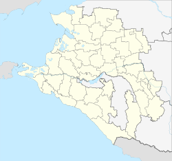
Stanitsa is located in the north of the Kuban area , about 170 km as the crow flies north of the regional administrative center of Krasnodar . It is located on the left bank of the Sossyka river , which is dammed up there to form the small Starominsk reservoir , and which flows into the Jeja a few kilometers north .
Starominskaya is the administrative center of the Starominskaya Rajon of the same name . In addition to Stanitsa, the village of Scholtyje Kopani, 20 km to the south-west, belongs to the rural settlement of Starominskaya.
history
The place was founded in 1794 by Zaporozhian Cossacks resettled in the area as " Kuren " (Cossack central settlement and meeting place) and was initially called Minskoye or Stanitsa Minskaya . The name was derived from the name of the place (today city) Mena and the tributary of the same name the Desna (formerly also in the form Mina ) not far from Chernihiv in northern Ukraine , the original region of origin of the Cossacks. With the emergence of an extension 25 km to the south from 1821, which later became Stanitsa Novominskaya ("New Minskaya"), the original Stanitsa was given the name Starominskaya ("Old Minskaya").
Since the middle of the 19th century the Stanitsa belonged to the department (Otdel) Yeisk of the Kuban Oblast . As part of an administrative reform, Starominskaya became the administrative center of a newly founded Rajon on June 2, 1924. During the Second World War , Staniza was occupied by the German Wehrmacht from August 5, 1942 to February 3, 1943 .
Population development
| year | Residents |
|---|---|
| 1861 | 4,858 |
| 1897 | 10,244 |
| 1939 | 19,372 |
| 1959 | 22,779 |
| 1970 | 26,373 |
| 1979 | 27,933 |
| 1989 | 30,743 |
| 2002 | 30,072 |
| 2010 | 29,809 |
Note : from 1897 census data
Economy and Infrastructure
In Starominskaya, as the center of an agricultural area, there are a number of companies in the food industry.
The place is also a railway junction with the two stations Starominskaya-Timashovskaya and Starominskaya-Jeiskaya . The former is located on the eastern edge of the village on the Rostov-on-Don - Krasnodar railway line (1451 km from Moscow ), which was opened as a branch line on the Starominskaya - Timashevskaya section in 1915. In 1964, when the Bataisk - Starominskaya gap was opened, the line became part of the shorter, double-track main line and direct connection from the north to Krasnodar and further to the health resorts on the Black Sea coast. The line was electrified in 1972. Starominskaya-Yeiskaya (route km 76) on the southern outskirts is located on the route from Pavlovskaya ( Sossyka-Rostovskaya station ) to the city of Yeisk , located a good 60 km northwest on the coast of the Azov Sea , which was opened in 1911, but has been on the section to Starominskaya since 1990s out of service. The routes are operated by the North Caucasian Railway .
Starominskaya is located on the R268 regional road , which connects the Krasnodar Regional Administrative Center with Bataisk. Further roads lead in an easterly direction to Stanitsa Kuschtschowskaja , which is almost 50 km away , where there is a connection to the M4 trunk road , which leads from Moscow via Rostov-on-Don and Krasnodar to the Black Sea coast , and in a south-easterly direction up the Sossyka to the large Stanitsa Leningradskaya and Pavlovskaya.
Individual evidence
- ↑ a b Itogi Vserossijskoj perepisi naselenija 2010 goda. Tom 1. Čislennostʹ i razmeščenie naselenija (Results of the All-Russian Census 2010. Volume 1. Number and distribution of the population). Tables 5 , pp. 12-209; 11 , pp. 312–979 (download from the website of the Federal Service for State Statistics of the Russian Federation)
- ↑ a b Starominskaja on the website of the Geographical Institute of the RAN (Russian)
- ↑ a b c History of Stanitsa and the Rajon on the official Rajon website (Russian, photos)
Web links
- Official website of Starominskaya Rajon and Stanitsa (Russian)


