Kholmskaya
| Staniza
Kholmskaya
Sholmskaya
|
||||||||||||||||||||||||||||||||||||||||
|
||||||||||||||||||||||||||||||||||||||||
|
||||||||||||||||||||||||||||||||||||||||
| List of large settlements in Russia | ||||||||||||||||||||||||||||||||||||||||
Cholmskaja ( Russian Холмская ) is a stanitsa in the Krasnodar region in Russia with 17,585 inhabitants (as of October 14, 2010).
geography
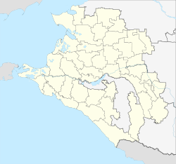
The place is located on the northern edge of the Greater Caucasus about 50 km as the crow flies southwest of the regional administrative center Krasnodar on the left Kuban tributary Chabl (also Sukhoi Chabl, "dry Chabl").
Kholmskaya belongs to Rajon Abinski and is located about 20 km east of the administrative center Abinsk . The settlement is the seat of the rural municipality of Cholmskoje selskoje posselenije, which also includes the settlements Novosadowy (30 km south), Nowy (14 km south-south-west), Sinegorsk (10 km south-south-west) and Sosnovaya Roschtscha (14 km south) and the hamlets (chutor) Chabl (11 km northwest), Erastov (14 km northeast), Kravchenko (12 km northeast), Krasnooktjabrski (10 km north), Pervomaiski (11 km northeast) and Vorobyov (13 km northeast) belong. All settlements are located in the forested mountains of the Caucasus, mainly in the valley of Chabl and its headwaters, Nowosadowy already beyond the relatively low there main ridge on a tributary of the Black Sea flowing Pschada . The hamlets are located in the intensely agricultural plain that slopes gently to the Kuban north of the Staniza.
history
The place was in 1863 at the end of the Caucasus war of resettled Azov - Cossacks founded and initially after the river as Chablskaja referred. The stanitsa got its current name as early as 1867, from Russian cholm for hill. From June 7, 1961 to 1997, the place had the status of an urban-type settlement ; at this time the form of the name Cholmski was official.
Population development
| year | Residents |
|---|---|
| 1939 | 9,647 |
| 1959 | 14,895 |
| 1970 | 16,324 |
| 1979 | 15,654 |
| 1989 | 15,547 |
| 2002 | 17,271 |
| 2010 | 17,585 |
Note: census data
traffic
The settlement is on the of the North Caucasian railway operated, 1888 opened on this section in 1994 and throughout the year 2000 electrified railway Tikhoretskaya - Krasnodar - Krymskaja - Novorossiysk (distance 725 kilometers from Volgograd ). The A146 trunk road , which connects the M4 near Krasnodar with the A290 (formerly M25) and represents a shorter alternative route to the Black Sea port of Novorossiysk, runs through Stanitsa .
Sons and daughters of the place
- Anatoly Serdyukov (* 1962), politician
Web links
- Official website of the municipality (Russian)
Individual evidence
- ↑ a b Itogi Vserossijskoj perepisi naselenija 2010 goda. Tom 1. Čislennostʹ i razmeščenie naselenija (Results of the All-Russian Census 2010. Volume 1. Number and distribution of the population). Tables 5 , pp. 12-209; 11 , pp. 312–979 (download from the website of the Federal Service for State Statistics of the Russian Federation)


