Novotitarovskaya
| Staniza
Nowotitarowskaja
Новотитаровская
|
||||||||||||||||||||||||||||||||||||
|
||||||||||||||||||||||||||||||||||||
|
||||||||||||||||||||||||||||||||||||
| List of large settlements in Russia | ||||||||||||||||||||||||||||||||||||
Nowotitarowskaja ( Russian Новотитаровская ) is a Staniza in the Krasnodar region ( Russia ) with 24 754 inhabitants (14 October 2010).
geography
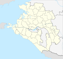
The Stanitsa is located in the central part of the Kuban area , a good 20 km north of the center of the regional capital Krasnodar on the upper reaches of the Ponura river .
Novotitarovskaya belongs to the Dinskaya Rajon and is located a good 15 kilometers west of its administrative center Dinskaya . The rural community (Selskoje posselenije) Novotitarowskaja includes the Stanitsa and the surrounding villages of Primaki and Imeni Karla Marksa (" Karl Marx Village") with a total of 1674 inhabitants (2009).
history
The history of Novotitarowskaya goes back to the Stanitsa Titarowskaya , which was founded in 1794 as one of the 40 first in the Kuban area on the Taman Peninsula and named after an ataman Titarow. By 1810, their population had grown to 4,776, so that a new hamlet was built on 20 farms from initially 62 resettlers on previously unused land in place of the current location. This subsequently also received the status of a Staniza and the name Novotitarowskaja ("New Titarowskaja"), while the original Staniza was now called Starotitarowskaja ("Old Titarowskaja").
As part of the administrative reform of 1924/1925, the Stanitsa was assigned to the Krasnodar Rajon, but in a further reform, which in many places included a reduction of the Rajons, by decision of December 31, 1934 center of an independent Rajon Novotitarowskaja.
During the Second World War , Stanitsa was occupied by the German Wehrmacht on August 8, 1942 while advancing from the Don to the North Caucasus and recaptured by the Red Army on February 12, 1943 .
On February 1, 1963, the Novotitarovskaya Rajon was dissolved and joined to the Dinskaya Rajon.
Population development
| year | Residents |
|---|---|
| 1876 | 5.117 |
| 1917 | 17,124 |
| 1939 | 8,805 |
| 1959 | 10,307 |
| 1979 | 17,149 |
| 2002 | 22,341 |
| 2010 | 24,754 |
Note: from 1939 census data
Culture and sights
During excavations in 1980, not far from Novotitarovskaya Kurgane from the Scythian period and chariot graves of a previously unknown type were discovered. The latter gave the name to the archaeological Novotitarovskaya culture .
Economy and Infrastructure
Novotitarovskaya is located in an important agricultural area; There are a number of companies, mainly in the food industry ( Bonduelle- Kuban vegetable canning factory , poultry farm, large-scale bakery) and the construction industry. Due to the proximity to the growing city of Krasnodar, the importance of the place as a residential area has grown in recent years.
The Staniza has a station on the North Caucasian railway operated railway Rostov-on-Don - Krasnodar (Station Name Titarowka at the eastern edge) on this section in May 1914 as part of the branch line Krasnodar - Primorsko-Akhtarsk (Station Achtari was opened). In 1964 the line became part of the shorter direct connection and main line from the north to Krasnodar and further to the health resorts on the Black Sea coast with the opening of the Bataisk - Starominskaya gap closure ; In 1972 it was electrified .
The R268 regional road from Bataisk to Krasnodar also runs through Stanitsa .
Individual evidence
- ↑ a b Itogi Vserossijskoj perepisi naselenija 2010 goda. Tom 1. Čislennostʹ i razmeščenie naselenija (Results of the All-Russian Census 2010. Volume 1. Number and distribution of the population). Tables 5 , pp. 12-209; 11 , pp. 312–979 (download from the website of the Federal Service for State Statistics of the Russian Federation)
- ↑ a b Osnovnye administrativno-territorial ' Nye preobrazovanija na Kubani (1793-1985 gg.) . Krasnodarskoe knižnoe izdatelʹstvo, Krasnodar 1986 ( The most important administrative-territorial reforms in the Kuban region (1793–1985) ; Russian).
Web links
- Official website of the local government (Russian)
- Novotitarovskaya on the Rajon Administration website (Russian)


