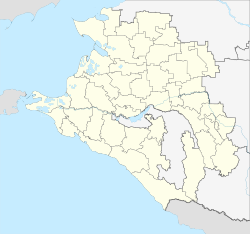
Severskaya
| Staniza
Severskaya
Северская
|
||||||||||||||||||||||||||||||||
|
||||||||||||||||||||||||||||||||
|
||||||||||||||||||||||||||||||||
| List of large settlements in Russia | ||||||||||||||||||||||||||||||||
Severskaya ( Russian Северская ) is a Staniza in the Krasnodar region ( Russia ) with 24 867 inhabitants (14 October 2010).
geography
Stanitsa is located on the northern edge of the western part of the Greater Caucasus , about 30 kilometers as the crow flies southwest of the regional administrative center of Krasnodar . The plain through which the Kuban flows extends north of the Stanitsa, and the first chain of the foothills of the Caucasus rises to a good 300 m above sea level immediately to the south . Severskaya is crossed by the river Ubin, which flows a good 10 kilometers northeast into the Shapsugskoje reservoir of the left Kuban tributary Afips .
Severskaya is the administrative center of the Severskaya Raion of the same name (Seversky) . The rural community of the same name (Selskoje posselenije Severskoje) includes the Staniza, the surrounding hamlets Bondarenko, Bontschkowski, Naumenkow, Novoalexejewski, Svobodny and Wolikow as well as the settlements Possjolok 8 Marta and Predgorny.
history
Stanitsa was founded in 1864 when Zaporozhian Cossacks were relocated to the area towards the end of the war against the Circassians (Adyge) in order to consolidate Russian positions in the region .
As part of an administrative reform, Severskaya was the first administrative center of a Rajons on July 19, 1924, which was later dissolved in the meantime.
During the Second World War , Severskaya was captured by the German Wehrmacht's 17th Army in mid-August 1942 during the summer offensive (“ Fall Blau ”) . At the beginning of mid-February 1943 the rapid advance of the Red Army in the area of Stanitsa came to a halt after their North Caucasian operation and the reconquest of Krasnodar; In the course of the spring of 1943, the forces of the Wehrmacht in the Kuban bridgehead could only be slowly pushed back from there in the direction of Krymskaya . The fighting over the Stanitsa lasted from February 12th to 18th, 1943.
Population development
| year | Residents |
|---|---|
| 1897 | 3,737 |
| 1939 | 8,272 |
| 1959 | 11,342 |
| 1970 | 14,369 |
| 1979 | 16,865 |
| 1989 | 19,707 |
| 2002 | 22,557 |
| 2010 | 24,867 |
Note: census data
Economy and Infrastructure
Severskaya is the center of an agricultural area (cultivation of wheat, rice, tobacco, fruit and vegetables as well as cattle and pig farming) with some businesses in the food industry.
Stanitsa is located on the Tichorezkaya - Krasnodar - Krymskaya - Novorossiysk railway line operated by Severo-Kawkasskaya zhelesnaja doroga , opened in 1888, electrified on this section in 1994 and continuously in 2000 (km 702 from Volgograd ). To the south, the Stanitsa is bypassed by the A146 trunk road, which connects the M4 at Krasnodar with the M25 and represents an alternative route to the Black Sea port of Novorossiysk.
Individual evidence
- ↑ a b Itogi Vserossijskoj perepisi naselenija 2010 goda. Tom 1. Čislennostʹ i razmeščenie naselenija (Results of the All-Russian Census 2010. Volume 1. Number and distribution of the population). Tables 5 , pp. 12-209; 11 , pp. 312–979 (download from the website of the Federal Service for State Statistics of the Russian Federation)
- ↑ a b Severskaya on the website of the Geographical Institute of the RAN (Russian)
Web links
- Official website of the Raion Administration (Russian)


