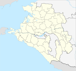
Novokubansk
| city
novokubansk
Новокубанск
|
||||||||||||||||||||||||||||||||||||||||
|
||||||||||||||||||||||||||||||||||||||||
|
||||||||||||||||||||||||||||||||||||||||
| List of cities in Russia | ||||||||||||||||||||||||||||||||||||||||
Novokubansk ( Russian Новокубанск ) is a city and district center with 34,880 inhabitants (as of October 14, 2010) in the Krasnodar region in southern Russia .
geography
Novokubansk is located in the foothills of the Caucasus on the left bank of the Kuban River and near the border between the Krasnodar and Stavropol regions . Novokubansk is 187 kilometers away from the subject capital Krasnodar to the west . The closest city is the city of Armavir , which is 12 km southeast of Novokubansk.
The city consists of two districts that emerged from former villages: Khutorok ( Хуторок ) and Sacharny ( Сахарный ).
history
The city was founded in 1867 as a village called Kubanskoye (Кубанское), which was founded by former soldiers of a Cossack army . Due to the influx of former farmers from central Russian regions, the place grew rapidly and in 1874 already had around 1500 inhabitants. In 1875 a railway line was laid through the place, which also brought new population with it.
Kubanskoye was dominated by agriculture until the 20th century. Since the end of the 19th century, the place had the status of a stanitsa with the name Novokubanskaya. In the early Soviet period , the first industrial companies and newer residential areas emerged. Khutorok , north of the Stanitsa, received urban-type settlement status in 1939 , which was renamed Novokubanski in 1961 . With the unification of the settlement and Stanitsa in 1966, the place received city rights under its current name.
Population development
| year | Residents | comment |
|---|---|---|
| 1939 | 16,905 | Novokubanskaya 8,260, Khutorok 8,645 |
| 1959 | 23,971 | Novokubanskaya 8,603, Khutorok 15,368 |
| 1970 | 23,904 | |
| 1979 | 27,146 | |
| 1989 | 30,201 | |
| 2002 | 35,400 | |
| 2010 | 34,880 |
Note: census data
Economy and Transport
As the center of a large agricultural area, Novokubansk is largely shaped by the food industry, and there is also a building materials plant in the city. The most important traffic connections are the M29 trunk road and the North Caucasian Railway , on whose main line from Rostov-on-Don to Nevinnomyssk and Mineralnye Vody Novokubansk there is a train station ( Kubanskaya ).
Individual evidence
- ↑ a b Itogi Vserossijskoj perepisi naselenija 2010 goda. Tom 1. Čislennostʹ i razmeščenie naselenija (Results of the All-Russian Census 2010. Volume 1. Number and distribution of the population). Tables 5 , pp. 12-209; 11 , pp. 312–979 (download from the website of the Federal Service for State Statistics of the Russian Federation)
Web links
- Unofficial city portal (Russian)
- Novokubansk on mojgorod.ru (Russian)
- Novokubansk photos (Russian)


