Belorechensk
| city
Belorechensk
Белореченск
|
||||||||||||||||||||||||||||||||||||||||||
|
||||||||||||||||||||||||||||||||||||||||||
|
||||||||||||||||||||||||||||||||||||||||||
| List of cities in Russia | ||||||||||||||||||||||||||||||||||||||||||
Beloretschensk ( Russian Белоре́ченск ) is a city with 53,892 inhabitants (as of October 14, 2010) and the center of the raion of the same name in the Krasnodar region in southern Russia .
location
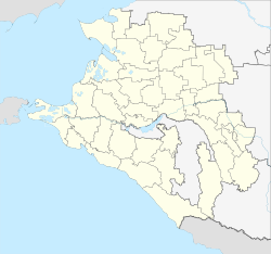
Belorechensk is located in the east of the Krasnodar region near the northern foothills of the Caucasus and the border with the autonomous republic of Adygea . The left Kuban tributary Belaja , which is also eponymous for the city, flows through the city (Beloretschensk = "city on the river Belaya", literally also "city on the white river"). The distance to the western regional capital Krasnodar is around 90 km, the closest city is the Adygea capital Maikop , 30 km southeast of Belorechensk.
history
The city was founded in 1863 as a fortress to protect against attacks by the Circassians . Originally it was called Belorechenskaya ( Белоре́ченская ) and was a stanitsa , a Cossack settlement typical of southern Russia . Already in 1864 the village had over 1000 souls, shortly before the October Revolution in 1917 there were already around 14,000, not least thanks to the construction of the North Caucasian Railway with a station in Belorechensk.
From August 1942 to January 1943, Belorechensk, like many places in the Kuban region, was occupied by the German Wehrmacht during the war of aggression against the Soviet Union . Until the liberation of the place it was heavily devastated, a large number of locals perished. The reconstruction of the village lasted until the 1950s. With effect from May 29, 1958, Beloretschensk, which meanwhile also had its own industrial plants, received city status.
Population development
| year | Residents |
|---|---|
| 1939 | 19,826 |
| 1959 | 35,864 |
| 1970 | 35,970 |
| 1979 | 42,960 |
| 1989 | 51,177 |
| 2002 | 54,028 |
| 2010 | 53,892 |
Note: census data
Economy and Transport
Beloretschensk, with its location at the intersection of two railway lines (the main line Armavir - Tuapse and a branch line to Adygea), is a traffic junction. The city also has several industrial plants, including various food factories, a fertilizer factory and a furniture factory.
Individual evidence
- ↑ a b Itogi Vserossijskoj perepisi naselenija 2010 goda. Tom 1. Čislennostʹ i razmeščenie naselenija (Results of the All-Russian Census 2010. Volume 1. Number and distribution of the population). Tables 5 , pp. 12-209; 11 , pp. 312–979 (download from the website of the Federal Service for State Statistics of the Russian Federation)
Web links
- Official website of the city administration (Russian)
- Official website of the Rajonsverwaltung (Russian)
- Belorechensk on mojgorod.ru (Russian)


