Slavyansk-na-Kubani
| city
Slavyansk-na-Kubani
Славянск-на-Кубани
|
||||||||||||||||||||||||||||||||||||||||||||
|
||||||||||||||||||||||||||||||||||||||||||||
|
||||||||||||||||||||||||||||||||||||||||||||
| List of cities in Russia | ||||||||||||||||||||||||||||||||||||||||||||
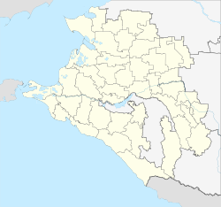
Slavyansk-na-Kubani ( Russian Славянск-на-Кубани ) is a city in southern Russia in the Krasnodar Territory and is the administrative center of Slavyansk Raion . It has 63,842 inhabitants (as of October 14, 2010) and is located almost 80 km west of the regional capital Krasnodar in the mouth of the Kuban River , directly at the Protoka estuary .
history
The place was founded in 1865 as Staniza ( Cossack village ) called Slavyanskaya - literally translated as "the Slavic " - although there had been Cossack settlements near today's city in earlier centuries. In the first decades after the town was founded, agriculture was the main activity. After a railway line had been laid through the village in 1913, the first industrial companies were established there.
Between the summer of 1942 and the spring of 1943, the site was occupied by German troops who had advanced south-east as part of Operation Blau during the failed Caucasus offensive . In 1958 Slavyanskaya received city rights and was renamed Slavyansk, with the addition "na Kubani" ("on the Kuban") necessary to avoid confusion with the city of Slovyansk in Ukraine (also Slavyansk in Russian ).
Population development
| year | Residents |
|---|---|
| 1897 | 15,167 |
| 1939 | 26,513 |
| 1959 | 38,954 |
| 1970 | 51,889 |
| 1979 | 54.051 |
| 1989 | 57,790 |
| 2002 | 64,136 |
| 2010 | 63,842 |
Note: census data
Economy and Infrastructure
The industry in Slavyansk is now represented by several food companies (including a winery), as well as factories for textiles, building materials and packaging. There is also a large sanatorium in the city that specializes in, among other things, treatments with local medicinal mud . Agriculture is still the dominant economic sector in the Slavyansk region.
The next trunk road, the M4 , runs near Krasnodar. Slavyansk has a station called "Protoka" on the railway line from Rostov-on-Don to Novorossiysk , which also connects to Moscow and other cities in Russia and Ukraine.
Slavyansk is the starting point for some bus routes to the surrounding towns and villages, and there are several minibus routes (so-called marshrutki ) for inner-city traffic .
education
There are two secondary educational institutions in the city:
- Slavyansk State Pedagogical University on Kuban
- Slavyansk Agricultural Technical College
sons and daughters of the town
- Tatjana Polnowa (* 1979), pole vaulter
- Yevgeny Lukyanenko (* 1985), pole vaulter
- Alexei Mirantschuk (* 1995), football player
Web links
- Slavyansk on mojgorod.ru (Russian)
- Unofficial city website (Russian)
Individual evidence
- ↑ a b Itogi Vserossijskoj perepisi naselenija 2010 goda. Tom 1. Čislennostʹ i razmeščenie naselenija (Results of the All-Russian Census 2010. Volume 1. Number and distribution of the population). Tables 5 , pp. 12-209; 11 , pp. 312–979 (download from the website of the Federal Service for State Statistics of the Russian Federation)


