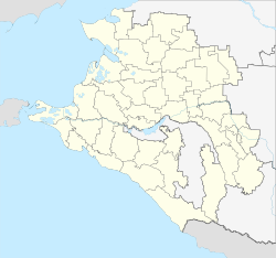
Leningradskaya
| Staniza
Leningradskaya
Ленинградская
|
||||||||||||||||||||||||||||||||||||
|
||||||||||||||||||||||||||||||||||||
|
||||||||||||||||||||||||||||||||||||
| List of large settlements in Russia | ||||||||||||||||||||||||||||||||||||
Leningradskaya ( Russian Ленинградская ) is a Staniza in the southern Russian region of Krasnodar with 36,940 inhabitants (14 October 2010).
geography
The Stanitsa is located in the north of the Kuban area , almost 150 km north of the regional capital Krasnodar on the left bank of the Sossyka , a tributary of the Jeja . Leningradskaja is the second largest stanitsa ( Cossack settlement ) in the region after Kanevskaya and thus the third largest in Russia.
The Stanitsa Leningradskaya is the administrative center of the eponymous Leningradskaya Rajon (Leningradski).
history
The history of Stanitsa began in 1794 when the first 40 Cossack settlements were established in the Kuban area. The colonizing here Zaporozhye Cossacks named the place after the city of Uman in today's Ukraine as Umanskoje or Umanski cures . In 1842, he was now as Staniza Umanskaja , administrative center of the okrugs Yeisk the Kuban Oblast and kept this administrative function to the 1869th
In 1911 the private Yeisk Railway from the Sossyka station (near Stanitsa Pavlovskaya ) on the main route of the North Caucasus Railway Rostov - Vladikavkaz to the city of Yeisk on the coast of the Azov Sea through Umanskaya.
During the Soviet period, during the collectivization of agriculture and the famine of 1932/33 , Umanskaya was one of the 13 stanizi of the Kuban area who were recorded on a so-called "black table" for allegedly withholding grain. As a result, a large part of the surviving residents of the Stanitsa (1200 families) were deported to the northern parts of the country or to Kazakhstan . In their place, families of members of the Red Army from the Belarusian and Leningrad military districts were settled, and on June 20, 1934 the Stanitsa was renamed Leningradskaya ("Leningrad Stanitsa"). In contrast to Stanitsa Poltavskaya , which was given the name Krasnoarmeiskaya (“Red Army Stanitsa”) in 1933 , but whose historical name was restored in the 1990s, Leningradskaya still bears the “Soviet” name today.
During the Second World War , Leningradskaya was occupied by the German Wehrmacht from summer 1942 to February 1943 .
Population development
| year | Residents |
|---|---|
| 1897 | 11,137 |
| 1913 | 23,800 |
| 1939 | 14,515 |
| 1959 | 17,824 |
| 1970 | 26,750 |
| 1979 | 30,707 |
| 1989 | 34,554 |
| 2002 | 38,218 |
| 2010 | 36,940 |
Note: except 1913 census data
Economy and Infrastructure
The Staniza is the center of an important agricultural area with predominant cultivation of grain (wheat, corn, barley) and technical crops (sunflowers, soy, sugar beet), but also livestock (cattle, pigs, poultry). There are several factories for processing agricultural products (sugar factory, dairy), as well as a ceramic product factory.
In Leningradskaja two streets cross which connect the east running trunk road M4 Moscow –Rostov – Novorossiysk with the western running regional road R268 Bataisk –Krasnodar: Kislyakowskaja – Staroderewjankowskaja / Kanewskaja and Pavlovskaja– Starominskaja .
The railway line leading through Leningradskaya (station name Umanskaya ) from Pavlovskaya ( Sossyka-Rostovskaya station ) to Yeisk has been out of service on the section to Starominskaya since the 1990s.
Individual evidence
- ↑ a b Itogi Vserossijskoj perepisi naselenija 2010 goda. Tom 1. Čislennostʹ i razmeščenie naselenija (Results of the All-Russian Census 2010. Volume 1. Number and distribution of the population). Tables 5 , pp. 12-209; 11 , pp. 312–979 (download from the website of the Federal Service for State Statistics of the Russian Federation)
Web links
- Leningradskaya Raion Web Portal (Russian)


