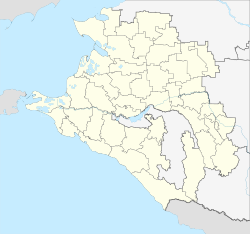
Otradnaya (Krasnodar)
| Staniza
Otradnaya
Otradnaya
|
||||||||||||||||||||||||||||||||||||||
|
||||||||||||||||||||||||||||||||||||||
|
||||||||||||||||||||||||||||||||||||||
| List of large settlements in Russia | ||||||||||||||||||||||||||||||||||||||
Otradnaja ( Russian Отра́дная ) is a stanitsa in the Krasnodar region ( Russia ) with 24,878 inhabitants (as of October 14, 2010).
geography
The place is located at the northern foot of the western part of the Greater Caucasus , a good 200 km as the crow flies southeast of the regional administrative center of Krasnodar . Stanitsa is located in the extreme southeast of the region, near the border with the Stavropol region and the Republic of Karachay-Cherkessia on the left bank of the Kuban tributary Urup . It is not to be confused with the smaller Stanitsa Otradnaya of the same name, which is located in the Tichorezk district, closer to Krasnodar.
Otradnaya is the administrative center of the Otradnaya Rajon of the same name . In addition to Stanitsa, the rural settlement of Otradnaja also includes the four villages Sadowy, Otrado-Soldatski, Novo-Urupski and Pokrowski with a total of 1,667 inhabitants, so that the total population is 24,397 (2008).
history
The stanitsa was in 1857 as part of the Laba - line of defense at the former southern border of the Russian Empire to the Caucasus in place of a destroyed Adyge Auls built. In the first years it was a military fortification under the name Ust-Tiginskaya (after the little river Bolshoi Tigin, which flows into the Urup), which served the 5th Brigade of the Cuban Cossack Army as headquarters . In 1873 Stanitsa was assigned to the department (Otdel) Batalpaschinsk of the Kuban Oblast .
On July 19, 1924, Otradnaya became the administrative center of a newly established Rajon, which after various administrative changes has belonged to the Krasnodar Territory since 1937.
Population development
| year | Residents |
|---|---|
| 1939 | 9,896 |
| 1959 | 11,570 |
| 1970 | 16.801 |
| 1979 | 18,672 |
| 1989 | 20,653 |
| 2002 | 22,692 |
| 2010 | 24,878 |
Note: census data
Culture and sights
A historical and archaeological museum has existed in Staniza since 1957 .
Economy and Infrastructure
In Otradnaya, as the center of an agricultural area with the predominant cultivation of maize , potatoes , vegetables and fruit, as well as cattle , pig and poultry farming, there are a number of companies in the food industry , as well as light industry and the construction industry .
The settlement is the regional road R255 , the km away from the 70 to the northwest Armavir the Urup up to the village Ilyich leads. The nearest train stations are about 50 km northeast in the city of Nevinnomyssk and the neighboring Kotschubejewskoje ( Bogoslowskaya station ).
Personalities
- Nonna Mordjukowa (1925-2008), film actress; hid or lived during and after the German occupation of the area in World War II from 1942 to 1944 near and in Otradnaya
Individual evidence
- ↑ a b Itogi Vserossijskoj perepisi naselenija 2010 goda. Tom 1. Čislennostʹ i razmeščenie naselenija (Results of the All-Russian Census 2010. Volume 1. Number and distribution of the population). Tables 5 , pp. 12-209; 11 , pp. 312–979 (download from the website of the Federal Service for State Statistics of the Russian Federation)
- ↑ a b c Stanitsa Otradnaja in the official information portal (Russian)
- ↑ a b Otradnaja on the website of the Geographical Institute of the RAN (Russian)
- ↑ Information about the museum at museum.ru (Russian)
Web links
- Official website of the rural municipality of Otradnaya (Russian)
- Official information portal of Rajon and Stanitsa Otradnaya (Russian)


