Poltavskaya
| Staniza
Poltava
Полтавская
|
||||||||||||||||||||||||||||||||||||||
|
||||||||||||||||||||||||||||||||||||||
|
||||||||||||||||||||||||||||||||||||||
| List of large settlements in Russia | ||||||||||||||||||||||||||||||||||||||
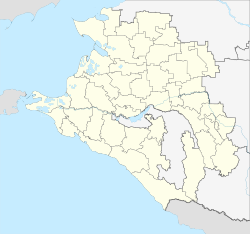
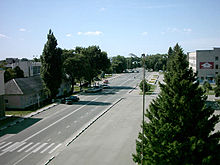
Poltawskaja ( Russian Полта́вская ) is a stanitsa in the Krasnodar region ( Russia ) with 26,490 inhabitants (as of October 14, 2010).
geography
The Staniza is located in the Kubandela , a good 10 kilometers from the right large estuary of the Kuban Protoka. It is located about 70 kilometers as the crow flies northwest of the regional administrative center of Krasnodar and a good 1 kilometer north of the city of Slavyansk on the Kuban .
Poltava is the administrative center of the Rajons Krasnoarmeiski .
history
The history of Stanitsa begins in 1794 when it was founded as one of the first 40 Cossack settlements in the Kuban area . The Zaporozhian Cossacks who settled here named them like their place of origin, the name of which was derived from the city of Poltava in today's Ukraine .
In the Soviet period, during the collectivization of agriculture and the famine of 1932/33 , Poltawskaya was one of the 13 stanizas in the Kuban area who were recorded on a so-called "black table" for allegedly withholding grain. As a result, a large part of the surviving residents of the Stanitsa were deported to the northern parts of the country or to Kazakhstan . In their place, families of members of the Red Army from the Belarusian and Leningrad military districts were settled, and in 1933 the Stanitsa were renamed Krasnoarmeiskaya ("Red Army Stanitsa"). In 1934 it became the center of a newly created Rajon.
During the Second World War , Krasnoarmeiskaya was occupied by the German Wehrmacht in the summer of 1942 . While advancing slowly against the German Kuban bridgehead on the Taman Peninsula , the Red Army recaptured the Stanitsa on March 9, 1943, after having been in the area of the main battle line for several weeks.
In 1994 the historical name of Stanitsa was restored, whereas the Rajon kept the Soviet name.
Population development
| year | Residents |
|---|---|
| 1861 | 4,871 |
| 1939 | 14,387 |
| 1959 | 13,594 |
| 1970 | 18,269 |
| 1979 | 21,785 |
| 1989 | 23,788 |
| 2002 | 28,639 |
| 2010 | 26,490 |
Note: census data from 1959
Culture and sights
There has been a history museum in Staniza since 1998 .
Personalities
- Mykola Michnowskyj (1873–1924), Ukrainian politician and pioneer of Ukrainian statehood, lived in Stanitsa in the early 1920s
Economy and Infrastructure
The Stanitsa Poltawskaja lies in the middle of the most important rice-growing area in Russia. In addition, other types of grain, sunflowers and vegetables are grown and cattle and poultry are kept. There are a number of farms processing agricultural products.
The railway line opened in 1915 from Krymskaya to Timashevsk via Slavyansk (route km 53) runs through Poltawskaya . Today it is part of one of several alternative routes that connect Rostov-on-Don with the holiday resorts on the Black Sea coast and was therefore electrified in 1987/1988 . There is also a road connection to Slavyansk (on the regional road R251 Kropotkin - Krasnodar - Temryuk ) and Timashevsk (on the regional road R268 Bataisk - Krasnodar).
West of Poltavskaya is a long-wave transmitter that is used for the RSDN-20 ( Alpha ) radio navigation system .
Individual evidence
- ↑ a b Itogi Vserossijskoj perepisi naselenija 2010 goda. Tom 1. Čislennostʹ i razmeščenie naselenija (Results of the All-Russian Census 2010. Volume 1. Number and distribution of the population). Tables 5 , pp. 12-209; 11 , pp. 312–979 (download from the website of the Federal Service for State Statistics of the Russian Federation)
- ↑ History on the Rajon Administration website (Russian)
- ↑ Andrej Grechko : The battle for the Caucasus . 2nd Edition. Deutscher Militärverlag, Berlin 1972 (Chapter 5 on the Kuban bridgehead in Russian ).
- ↑ Information about the museum at museum.ru (Russian)
Web links
- Rajon Administration Portal (Russian)


