Ladozhskaya
| Staniza
Ladozhskaya
Ladozhskaya
|
||||||||||||||||||||||||||||||||||
|
||||||||||||||||||||||||||||||||||
|
||||||||||||||||||||||||||||||||||
| List of large settlements in Russia | ||||||||||||||||||||||||||||||||||
Ladoschskaja ( Russian Ла́дожская ) is a staniza in the Krasnodar region in Russia with 14,828 inhabitants (as of October 14, 2010).
geography
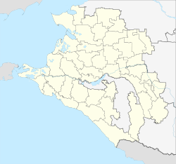
The place is in the foothills of the Caucasus a good 80 km as the crow flies east-northeast of the regional administrative center Krasnodar , on the right bank of the Kuban .
Ladoschskaja belongs to the Ust-Labinsky Rajon and is located a good 20 km northeast of its administrative center Ust-Labinsk . The settlement is the seat of the rural municipality Ladoschskoje selskoje posselenije, which also includes the hamlet (chutor) Potajonny (10 km northeast).
history
Stanitsa was founded in 1802 by Cossacks from Dnepr . In 1804 more Don Cossacks were resettled. The stanitsa was named after the Ladoga - infantry regiment (polk Ladoschski pechotny), consisting of Saint Petersburg there, near the former southern border of the Russian Empire had been moved.
From 1934 to 1953 Ladoshskaya was the administrative seat of a raion named after her.
Population development
| year | Residents |
|---|---|
| 1939 | 8,858 |
| 1959 | 10,607 |
| 1979 | 13,169 |
| 2002 | 14,714 |
| 2010 | 14,828 |
Note: census data
traffic
Ladoschskaya has a train station at kilometer 54 of the Kawkasskaya ( Kropotkin ) - Krasnodar railway line, which opened in 1901 and has been electrified since 1999 . The regional road 03K-002 Temryuk - Krasnodar - Kropotkin - border to the Stavropol region (from there towards Stavropol ) passes on the northern edge of the village.
Web links
- Official website of the local government (Russian)
Individual evidence
- ↑ a b Itogi Vserossijskoj perepisi naselenija 2010 goda. Tom 1. Čislennostʹ i razmeščenie naselenija (Results of the All-Russian Census 2010. Volume 1. Number and distribution of the population). Tables 5 , pp. 12-209; 11 , pp. 312–979 (download from the website of the Federal Service for State Statistics of the Russian Federation)


